SITE CONTENT
Antique Maps & Prints
Britain
Antique Maps - World
Antique Books
Cartographers
Early Prints
Other Stock
|
| Maps, Prints & Books of Asia. |
Images |
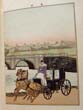
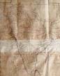
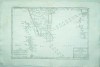
(Code No. 6896).Speed, John (1551- 1629).A New Mappe of the Roman Empire newly described by John Speede and are to be found in pops head alley by G Humble.Date 1626.London. G Humble. Image size [20 x 15 1/2ins]. Original copper engraved framed map by John Speed of the Roman Empire, glazed front and back. 7 very small worm holes. Good margins. Hand-coloured. Not examined outside of frame.While working in London, Speed was a tailor and member of a corresponding guild, and came to the attention of "learned" individuals. These individuals included Sir Fulke Greville, who subsequently made him an allowance to enable him to devote his whole attention to research. By 1598 he had enough patronage to leave his manual labour job and "engage in full-time scholarship." As a reward for his earlier efforts, Queen Elizabeth granted Speed the use of a room in the Custom House. Speed, was, by this point, as "tailor turned scholar" who had a highly developed "pictorial sense".........
|
SOLD.
|
(Code No. 6870)
Skeen & Co.
( Antique photograph).. Number 845.
Library and Lake, Kandy, Ceylon.
Date. (c.1880).
Sri Lanka, (Ceylon). Image size (approx) [11 x 8 1/2ins]. Original albumen photograph, slight crease mark.
Photography was introduced to Sri Lanka in the 1840s and by the end of the 19th century was practiced extensively, both local and foreign artists recording the many facets of the beautiful island. Skeen's firm, set up in Colombo in the 1860s, comprised the most famous photographers of the 19th century in Sri Lanka, extensively documenting industry, landscape and racial types and exhibiting at major international exhibitions between 1870-1900..(British Library)........... £120.00 |
Click on picture above to view more images
How to order |
(Code No. 6867)
Skeen & Co. Kandy.
( 2 Antique Photographs, laid on to card).
House & river scean,.
Date. (c.1880).
Colombo. Sri Lanka, (Ceylon). Image size (approx) [11 x 9ins]. 2 Original albumen photograph recto and verso, nick to bottom edge..
Photography was introduced to Sri Lanka in the 1840s and by the end of the 19th century was practiced extensively, both local and foreign artists recording the many facets of the beautiful island. Skeen's firm, set up in Colombo in the 1860s, comprised the most famous photographers of the 19th century in Sri Lanka, extensively documenting industry, landscape and racial types and exhibiting at major international exhibitions between 1870-1900..(British Library)....... £65.00 |
Click on picture above to view more images
How to order |
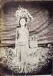
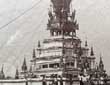
(Code No. 6862)
Anon.
(2 Antique photographs on one leaf, laid on to card).
(Attributed to) The Shwedagon pagoda, Yangon, Myanmar, Burma. + Burmese girl flower seller.
Date. (c.1880).
Burma. (approx), Image size [8 x 6ins] 2 Original albumen photograph recto and verso. Shwedagon pagoda, slight nick to top edge, (1/2ins) + Burmese girl flower seller. There appears to be repair work being carried out at the base of the Pagoda. Very Rare....... £350.00 |
Click on picture above to view more images
How to order |
(Code No. 6861)
Anon.
(2 Antique photographs on one leaf, laid on to card).
Children selling jackfruit + Large house.
Date. (c.1880).
Burma, (approx), Image size [8 x 6ins] 2 Original albumen photograph recto and verso of children selling jackfruit + Large house, nick to bottom edge, (1/2ins). The jackfruit has played a significant role in Indian agriculture for centuries. Archeological findings in India have revealed that jackfruit was cultivated in India 3000 to 6000 years ago. It has also been widely cultivated in southeast Asia. Stingless bees such as Tetragonula iridipennis are jackfruit pollinators, and as such, play an important role in jackfruit cultivation...... £100.00 |
Click on picture above to view more images
How to order |
(Code No. 6860)
Anon.
(Antique Photograph laid on to card).
Houseboat and river ransporton on a river, (attributed to) Ceylon..
Date. (c.1880).
Sri Lanka, (Ceylon). Image size (approx) [8 x 6ins]. Original albumen photograph of Houseboats and river transporton on a river,(attributed to), Ceylon. showing a European 3 masted sailing ship in the background...... £90.00 |
Click on picture above to view more images
How to order |
(Code No. 6857)
(Possibly by),,Skeen & Co. Kandy.
(Antique Photograph, laid on to card).
The Clock Tower From Upper Chatham Street (W to E).
Date. (c.1880).
Colombo. Sri Lanka, (Ceylon). Image size (approx) [11 x 8 3/4ins]. Original albumen photograph, slight foxing & crease to top right corner.
The Clock Tower is located in Colombo Fort, the Old Colombo Lighthouse or the Colombo Fort Clock Tower was a light house in Colombo. The structure is found at the junction of Chatham Street and Janadhipathi Mawatha (Queens Road). Originally a lighthouse and then demolished, the current clock tower was constructed in 1856-57....... £90.00 |
Click on picture above to view more images
How to order |
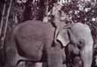
(Code No. 6855)
Skeen & Co. Kandy.
(Antique Photograph, laid on to card).
CONTROLLING ELEPHANTS. Working Elephants in Captivity.
Date. (c.1880).
Sri Lanka, (Ceylon). Image size (approx) [11 x 8 3/4ins]. Original albumen photograph, a few creases. Photography was introduced to Sri Lanka in the 1840s and by the end of the 19th century was practiced extensively, both local and foreign artists recording the many facets of the beautiful island. Skeen's firm, set up in Colombo in the 1860s, comprised the most famous photographers of the 19th century in Sri Lanka, extensively documenting industry, landscape and racial types and exhibiting at major international exhibitions between 1870-1900..(British Library)........ £165.00 |
Click on picture above to view more images
How to order |
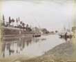
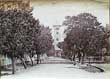
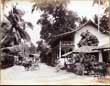
(Code No. 6853)
Skeen & Co. Kandy.
(Antique Photograph, laid on to card).
House & Street sceen.
Date. (c.1880).
Colombo. Sri Lanka, (Ceylon). Image size (approx) [11 x 8 3/4ins]. Original albumen photograph, a few creases. Photography was introduced to Sri Lanka in the 1840s and by the end of the 19th century was practiced extensively, both local and foreign artists recording the many facets of the beautiful island. Skeen's firm, set up in Colombo in the 1860s, comprised the most famous photographers of the 19th century in Sri Lanka, extensively documenting industry, landscape and racial types and exhibiting at major international exhibitions between 1870-1900..(British Library).......... £65.00 |
Click on picture above to view more images
How to order |
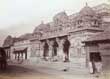
(Code No. 6852)
Skeen & Co. Kandy.
(Antique Photograph, laid on to card).
Hindu Temple,
Date. (c.1880).
Colombo. Sri Lanka, (Ceylon). Image size (approx) [11 x 8 1/2ins]. . Original albumen photograph, slight nick to bottom left cornrer, ((approx, 1/8ins).
Photography was introduced to Sri Lanka in the 1840s and by the end of the 19th century was practiced extensively, both local and foreign artists recording the many facets of the beautiful island. Skeen's firm, set up in Colombo in the 1860s, comprised the most famous photographers of the 19th century in Sri Lanka, extensively documenting industry, landscape and racial types and exhibiting at major international exhibitions between 1870-1900..(British Library)......... £65.00 |
Click on picture above to view more images
How to order |
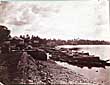
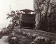
(Code No. 6849)
Skeen & Co. Kandy.
(Antique Photograph, laid on to card).
Colombo-Kandy Railway. Sensation Rock. Sri Lanka, (Ceylon). Image size (approx) [8 1/2 x 10 3/4ins].. Original albumen photograph, slight nick to bottom right cornrer, ((approx, 1/8ins).
Date. (c.1880).
Photograph of the railway from Colombo to Kandy in Sri Lanka, taken by William Henry Louis Skeen & Co. in the 1870s. Photography was introduced to Sri Lanka in the 1840s and by the end of the 19th century was practiced extensively, both local and foreign artists recording the many facets of the beautiful island. Skeen's firm, set up in Colombo in the 1860s, comprised the most famous photographers of the 19th century in Sri Lanka, extensively documenting industry, landscape and racial types and exhibiting at major international exhibitions between 1870-1900. It also recorded the construction of the Ceylon Railways between the 1860s and 1890s. This view shows a locomotive on the line, with a steep drop on the leftt. British rule in Sri Lanka began in 1815 when the last bastion of the Sinhalese kings, the central hill region of Kandy, caved in after resisting colonial rule for 300 years after the fall of the coastal regions. In 1842 English coffee planters clamoured for a railway from Kandy to Colombo, to transport their estate produce for shipment quickly and regularly, as they had by then opened up virgin lands in the hill country to grow coffee, a viable commercial crop. The construction of the Ceylon Railways was a feat of engineering accomplished over difficult terrain with steep inclines, involving tunneling, cutting through solid rock formations, building steep embankments over valleys and ravines and constructing bridges and culverts. (British Library)....... £65.00 |
Click on picture above to view more images
How to order |
(Code No. 6845)
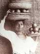
Scowen, Charles T ?
(Antique Photograph, laid on to card).
Fruit Seller.
Date. (c.1880).
Colombo, Ceylon. Sri Lanka.. India ,Sri Lanka. Image size [11 x 8 1/2ins]. Original albumen photograph of a Singhalese Girl, carrying fruit, .possibly by Charles T. Scowen.......... £100.00 |
Click on picture above to view more images
How to order |
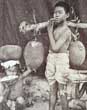
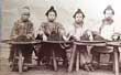
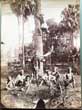
(Code No. 6844)
Anon.
(Antique Photograph, laid on to card).
Tea sorters in China.
Date. (c.1870).
China. Image size [9 1/4 x 7ins].. Original albumen photograph of tea sorters in China. Laid on to card. Possibly by Miller, Marshall Milton.
Black teas, after being partially dried in the sun, and slightly fired, are rolled either by the palm of the hand on a flat tray, or by the foot in a hempen bag. They are scorched in iron pans over a slow charcoal fire, and after this spread out on bamboo trays, that the broken stems and refuse leaves may be picked out. It is this operation, which is performed by women or children, that is shown in the photograph. The teas are then separated by passing them through sieves, so as to form different sizes and qualities of tea. The greatest care and economy are observed in carrying all these processes on, the tea-dust being gathered up and used in forming a very inferior tea....... £1100.00 |
Click on picture above to view more images
How to order |
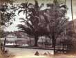
(Code No. 6843)
Skeen & Co. Kandy.
(Antique Photograph, laid on to card).
Palms at Peradeniya Gardens. Ravenala Madagascariensis. Traveller's Palm .
Date. (c.1880).
India ,Sri Lanka. Image size [11 x 8 1/2ins]. Original albumen photograph taken in the Peradeniya Gardens of the Ravenala Madagascariensis. Traveller's Palm, very good...
William Skeen, father of W.L.H. Skeen, was the first official Ceylon Government Printer from 1849 to 1872. He was the author of 'The Knuckles and other poems' and 'Adam's peak'. He purchased the photographic business of J. Parting for his son in 1860. The business originally traded under the name of S. Slinn and Co. and was managed by S. Slinn Skeen and John Edward Wilshaw. The firm had premises in the Fort district, Colombo. S. Slinn Skeen had arrived in Ceylon aboard the 'Colombo' in September 1860. He left for England aboard the 'Huguenot' in November 1861. In 1863 the company advertised a new studio at 1 Baille Street, Fort. For many years the firm also sold stationery, jewellery, watches and other items. The firm changed its name to W.L.H. Skeen and Co. by the late 1860s........ £60.00
|
Click on picture above to view more images
How to order |
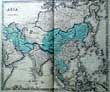
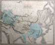
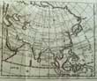
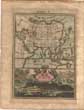
(Code No. 6836)
Philip, Georgr.
(Large antique map).
ASIA..
Date. 1851.
Liverpool, George Philip & Son. Page Size [ 26 1/2 x 21 1/2 ins]. Original engraved hand tinted map by J. Gellatly of Edinburgh, slight split to bottom centre fold, (1ins) and a crease to engraved area........ £40.00 |
Click on picture above to view more images
How to order |
(Code No. 6803)
Philip. (George).
Independent and Chinese Tartary, Hindostan, China &c.
(Antique map).
Date. 1851.
Liverpool, George Philip & Son. Map size [23 3/4 x 20ins]. Original steel engraved map, printed by J. Gellatly, slight marginal nicks not affecting image...... £65.00 |
Click on picture above to view more images
How to order |
(Code No. 6788)
Anon.
(2 Antique photographs on one leaf, laid on to card).
(Attributed to) The Shwedagon pagoda, Yangon, Myanmar, Burma. + Burmese girl's meal time.
Date. (c.1880).
Burma. (approx), Image size [8 x 6ins] .. 2 Original albumen photograph recto and verso. Building the Shwedagon pagoda + Burmese girl's meal time. Very Rare...... £400.00 |
Click on picture above to view more images
How to order |
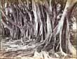
(Code No. 6787)
Skeen & Co. Kandy.
Indian rubber trees.
Date. (c.1880).
Sri Lanka, (Ceylon). Image size (approx) [11 x 8 3/4ins]. Original albumen photograph, slight nick to right side.
Photography was introduced to Sri Lanka in the 1840s and by the end of the 19th century was practiced extensively, both local and foreign artists recording the many facets of the beautiful island. Skeen's firm, set up in Colombo in the 1860s, comprised the most famous photographers of the 19th century in Sri Lanka, extensively documenting industry, landscape and racial types and exhibiting at major international exhibitions between 1870-1900..(British Library). Indian rubber tree, is a species of plant in the fig genus, native to east India, Nepal, Bhutan, Burma, China (Yunnan), Malaysia, and Indonesia. It has become naturalized in Sri Lanka, the West Indies, and the US State of Florida........ £100.00 |
Click on picture above to view more images
How to order |
(Code No. 6786)
Anon.
(Antique Photograph).
Photograph (attributed to) Sinhalese Vedda tribesmen.
Date. (c.1880).
Sri Lanka. Image size [8 x 6 1/4ins].
Original albumen photograph of Veddas tribesmen who were originally hunter-gatherers. They used bows and arrows to hunt game, harpoons and toxic plants for fishing and gathered wild plants, yams, honey, fruit and nuts. Many Veddas also farm, frequently using slash and burn or swidden cultivation, which is called "chena" in Sri Lanka. East Coast Veddas also practice sea fishing. Veddas are famously known for their rich meat diet. The Veddas kill only for food and do not harm young or pregnant animals. Game is commonly shared amongst the family and clan. Fish are caught by employing fish poisons. Split to top edge, approx (2ins) + printer's crease........ £180.00 |
Click on picture above to view more images
How to order |
(Code No. 6785)
Anon.
(Antique Photograph).
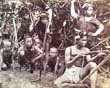
Photograph (attributed to) Burmese tribesmen.
Date. (c.1880).
Burma. Image size [8 x 6 1/4ins]
Original albumen photograph of Burmese tribesmen. ....... £180.00 |
Click on picture above to view more images
How to order |
(Code No. 6782)
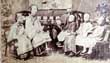
Milton M. Miller (American, 1830 - 1899).
(Antique photograph).
Chinese Family.
Date. (c.1864).
China, Hong Kong. Image size (approx). [9 3/4 x 7 3/4ins]. Original albumen silver print photograph of Chinese Family .Laid on to card. Paper crinkling throughout & edge splits.. Image size less than the Getty Museum's example.
Milton M. Miller (1830-1899), the American photographer active in Hong Kong, Canton, and Japan in the early 1860s, is one of the rare early Western photographers working in Asia who focused almost exclusively on portraiture. Few photographers attracted a wider range of portrait patrons: his Hong Kong sitters include Chinese, American, Parsi, European and Japanese clients; although his works include portraits of single sitters, his is notable for the number of pair and group portraits it contains......... £1100.00 |
Click on picture above to view more images
How to order |
(Code No. 6725)
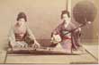
Anon.
10 Loose albumen hand-tinted Japanese photographs.
Date. (c.1890).
Japan. Image size [5 1/2 x 3 1/2ins] 10 albumen hand-tinted photographs on.board mounted, 3 with English titles & numbers in the negative, mixed set various photographers.
Showing :- 5 Views + 5 Women. One photo foxed. All blank margins marked with edge nicks. Images on each side of boards...... £40.00 |
Click on picture above to view more images
How to order |
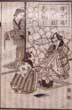
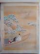
(Code No. 6707)Kinbei, Kusakabe. F. Beato & others unknown.Japanese photograph album.Date. [c.1880]. Japan. Oblong folio (14 x 10 3/4 ins).50 hand-coloured albumen photographs, recto and verso on card mounts. including (approx) 5 Temples + 17 views (Yokohama etc) + 9 trades + 18 men & woman + 1 soldier.. Leather spine over lacquered pictorial covers, front covers decorated with hand painted scenes of women on a jinrikishas, lacks image of a man's face. Gilt edges......
|
SOLD.
|
(Code No. 6600)
Bird. Isabella L.( Mrs. Bishop).
The Hawaiian Archipelago: Six Months Amongst the Palm Groves, Coral Reefs, and Volcanoes of the Sandwich Islands.
Date. 1905.2nd. Edn.
. London, Murray. 8vo, [6 x 8 1/4ins]. Pp xv, 318, 2pp adverts + 3 full page illus + 1 Folding map + Text illustrations, foxing spots.
Six months amongst the palm groves, coral reefs and volcanoes of the Sandwich Islands.. Green cloth gilt. Slight staining and fading...... £30.00 |

Click on picture above to view more images
How to order |
(Code No. 6559)
Salaman, Malcolm C..
Elizabeth Keith. [1887 - 1956]. [Masters of the Colour Print. no. 9.]
Date. 1933.
London : The Studio ; New York : Studio Publications, 4to, [12 x 9 3/ins] Pp. 6 + 8 Coloured prints of Japanese scenes & life. very good condition. Original printed boards, Spine with slight loss.
The Scottish-born artist Elizabeth Keith first went to Japan in 1915. This intended holiday developed into a wandering stay of nine years, during which time Elizabeth Keith travelled widely throughout the Orient. She achieved local notoriety in Tokyo in 1917 with the publication of a group of caricatures which she had made of local socialites and dignitaries. It was after one of these designs was translated into a traditional Japanese-style woodblock print by another artist that Elizabeth Keith first became interested in this art form...... £60.00 |
Click on picture above to view more images
How to order |
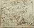
(Code No. 6547)
Taylor, C.
(Antique Map).
Map of Asia.
Date. August 1st, 1814.
London, Published by C. Taylor. Page size, [10 1/4 x 8 1/2ins]. Original copper engraved map by C.Taylor, slight marks...... £30.00 |
Click on picture above to view more images
How to order |
(Code No. 6518)Wild. John James.At anchor; a narrative of experiences afloat and ashore during the voyage of H.M.S. Challenger, from 1872 to 1876 .Date. 1878. First edition. London: Marcus Ward and Co. Folio, [11 1/2 x 14 1/2ins].. Owner's book plate on front past down. Pp. 198. + 13 mounted chromolithographic plates + double page map + many text illustrations throughout + Original watercolour on half title page. Original gilt decorated cloth, rubbed & faded.On pages 165-171, Wild describes the island of Hawaii and the tsunamis of 1837 and 1877 at Hilo. The latter wave was 36 ft high at Kealakekua. He reports a glow from the summit caldera of Mauna Loa on August 13, 1875, and describes lava flowing out of Mokuaweoweo in August 1875. Heavy Book.......
|
SOLD.
|
(Code No. 6396)Johnston, Keith.(Antique map).CHINA.Date. [c.1850].London. Edinburgh. John & W & A.K. Johnston. Approx page size, 21 1/2 x 26 1/2 ins. Hand-coloured in outline double page map, with an inset map of Canton, Central fold ( loose, no text or covers). Engraved and Printed by W & A. K. Johnston, vg....Alexander Keith Johnston (1804-1871) was born at Kirkhill near Edinburgh. After an education at the high school and the University of Edinburgh he was apprenticed to an engraver; and in 1826 joined his brother (who would become Sir William Johnston, Lord Provost of Edinburgh) in a printing and engraving business, forming the well-known cartographical firm of W. and A. K. Johnston. The rest of Johnston's life was devoted to geography, his later years to its educational aspects especially. His services were recognised by the leading scientific societies of Europe and America. He died at Ben Rhydding, Yorkshire, in 1871........
|
SOLD.
|
(Code No. 6383)
Candlin, George T. John Innocent:
A Story of Mission Work in North China.
Date. 1909.
London, United Methodist Pub. House. 8vo, [5 x 7ins]...Pp. xvi, 305 + 25 Photographs and line drawings. Original cloth gilt.
John Innocent, (1829-1904), was regarded as the father of the mission and was possibly the first Protestant missionary to work in Tientsin, North China. In everything he exercised consideration and sympathy. He saw the development of churches and schools, helped establish a hospital and dispensary. The breaking of fresh ground was important to him. But his heart was in China and in fact he had been appointed as Principal of the Tientsin Training Institution in 1899. Very rare edition....... £110.00 |
Click on picture above to view more images
How to order |
(Code No. 6339)
Cave, Henry W.
The Ruined Cities of Ceylon.
London, Sampson Low, Marston and Company Ltd. 4to, 1900. Pp. (11), 165, (8), (1 advert) + Map + 65 plates , very good. Gilt decorated cloth, surface loss to spine. Gilt top edge. £35.00 |
Click on picture above to view more images
How to order |
Code No. 6326.
Cole, B.
The Commerce of the Europeans in ASIA..
( Antique Map).
Date. 1760.
London: Stanley Crowder. Page size [8 x 7ins]. Original copper engraved folding map of ASIA.., very good condition..... £50.00 |
Click on picture above to view more images
How to order |
(Code No. 6234)The Times of India Annual ,Date. 1930.[Bombay] 4to, [14 x 10ins]. 1930. Lacks prelims. Not numbered, [pp.146]. Including 30 full page coloured adverts + black and white adverts and articles, etc. Marks and edge nicks. Sold as a collection of plates only......
|
SOLD.
|
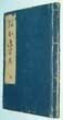
(Code No. 6161)
Biographies of the Celestial Beings on the Flat Peach Efte .
The Story of Chinese characters.
No Date.
China, 8vo, [8 x 6ins]. 10 Hand-coloured sketches on silk, displayed in a pull out concertina style, each sketch with a descriptive text in English & Chinese. Wood covers. Very good condition....... £120.00 |
Click on picture above to view more images
How to order |
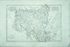
(Code No. 6109)Kitchin. Thos.(Antique Map)."MAP of the EUROPEAN SETTLEMENTS in EAST INDIES and on the Eastern coast of AFRICA, by Thos. Kitchin, Hydrographer to His Majesty".Date. 1784.Dublin. John Exshaw. Image size [18 x 12 1/2 ins]. Page size [19 x 14 ins]. Copper engraved folding map taken from Abbe Raynal's (1713-1796) " A Philosophical and Political History of the Settlements and Trade of the Europeans in the East and West Indies"The map covers Australia to Cape, East Africa and most of Asia. The map has a garland style title cartouche, two scale lines, (1" to 320 miles), graduated borders inset panel of Ceylon. Closed split at centre fold (2 1/2 ins), vg. .......
|
SOLD.
|
(Code No. 5927)The Story of Chinese Fashion.(Chinese picture book).No date..China, 8vo, [5 x 7ins]. 12 Hand-coloured sketches on silk, displayed in a pull out concertina style, each sketch with a descriptive text in English & Chinese, one page with a closed split to text page. Wood covers with an Chinese character on front cover in relief. The sketches show the various stages of silk production.......
|
SOLD.
|
(Code No. 5808)
Bushell, Stephen. W.
Chinese Art.
Volumes 1 & 2.
Date. 1910 & 1924 editions.
London, Victoria & Albert Museum. 8vo, [5 1/2 x 8 1/2ins]. Pp. xiii, 158. xii, 142 + Illustrations throughout. Not matching sizes, volume 1 slightly taller. Original cloth gilt, slight rubbing.
Listing :- Porcelain, Glass; Enamel, Jewellery, Textile, Sculpture, Architect, Bronze, Wood, Ivory, Jade, Enamels, Cloisonné, Champlevé, Woven Silks, Embroidery, Carpets, etc...... £50.00 |
Click on picture above to view more images
How to order |
(Code No. 5807)Hall. Sidney.( Antique Map of Asia.)ASIA.Date. 1829.London. Longman, Rees etc. Page Size [23 1/2 x 19 1/2 ins]. Original hand coloured copper engraved map by Sidney Hall. Closed splits to fold.....
|
SOLD.
|
(Code No. 5799)
Russell, John.
(Antique Map of INDIA).
HINDOSTAN or INDIA , Drawn from the best Authorities.
Date. 1799.
London. Published as the Act directs by C. Dilly and others. Page size [22 x 17 ins]. Image size [18 x 15 1/2 ins]. Original copper engraved map by John Russell with original outline hand colour. From the Guthries's Geography, slight split to fold not affecting engraved area & slight marks.. ....
£75.00 |
Click on picture above to view more images
How to order |
(Code No. 5798)Johnstone; John. W. & A.K. Johnston.(Antique Map).INDIA.Date. 1846.Edinburgh :John Johnstone; W. & A.K. Johnston. Page size, [21 1/2 x 26ins]. Original double page steel engraved map with outline hand-colouring. Names of military stations underlined......
|
SOLD.
|
(Code No. 5797)
Kitchin, Thomas & Frederic Hervey.
(Antique Map).
A General Map of INDIA, including the Empire of Hindostan, with the Kingdom of Bengal & its other dependencies.
Date. 1773.
London, F. H. Esq. and others. Page size [14 1/2 x 17 1/4ins]. Original copper engraved folding map, engraved by T. Kitchin, split into engraved area, (1 1/2ins), repaired, and also pasted at corners on to card.
Thomas Kitchin (1719-1784) was an English engraver and map-maker, who became hydrographer to the king...... £90.00
|
Click on picture above to view more images
How to order |
(Code No. 5796)
Delisle. Guillaume.
(Antique Map.)
INDIA. Carte des Côtes de Malabar et de Coromandel presentee au Roy....... tres obeissant et tres fidele sujet, G. Delisle ".
Date.1745.
Paris. Page size, [24 x 19ins].. Original hand-coloured copper engraved map of South India. Ornamental title cartouche.
The de L'Isle family was one of the most influential Geographers of the early 18th century in France. Claude de L'Isle, born 1644, had four sons, of which Guillaume was the most notable. Guillaume was born 1675 and became member of the "Académie Royale des Sciences" at the age of twenty-seven, and was honoured later with the title "Premier Géographe du Roi"." He died in 1726........£190.00 |
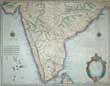
Click on picture above to view more images
How to order |
(Code No. 5785)Menpes, Mortimer & Dorothy Menepes.The Durbar by Mortimer Menpes.Date. 1903.London, Adam & Charles Black. 8vo, [9 x 6 1/2ins]. Pp xiii, 210 + 100 tissue guarded colour plates. Original gilt decorated cloth, chipping to top & bottom of spine, no loss.The Delhi Durbar meaning "Court of Delhi", was a mass assembly at Coronation Park, Delhi, India, to mark the coronation of a King and Queen of the United Kingdom. Also known as the Imperial Durbar, it was held three times, in 1877, 1903, and 1911, at the height of the British Empire. The 1911 Durbar was the only one attended by the sovereign, who was George V. The term was derived from common Mughal term durbar........
|
SOLD.
|
(Code No. 5783)Sleeman, William Henry, (1788 – 1856).Rambles and Recollections of an Indian Official.Volume 1 of 2.Date. 1844.London, J. Hatchard and Son. 8vo, [10 x 7ins]. 478 + Colour portrait frontis of The Emperor of Delhi + 6 Coloured botanical prints. Original gilt decorated cloth, split to cloth hinges & chipping. Holding firm.In 1809 William Sleeman joined the Bengal Army, served in the Nepal War (1814–1816), and in 1820 became assistant to the Governor-General's agent in the Saugor and Nerbudda territories. He is best known for his suppression of the Thuggee secret society........
|
SOLD.
|
(Code No. 5779)Coronation Durbar, Delhi 1903.Official directory (with maps).Date. 1903.Delhi : Foreign Office Press. 8vo, [5 x 7 1/4ins]. Pp. 268 + 4 Folding maps in front pocket, very good condition. Original cloth gilt.The Delhi Durbar meaning "Court of Delhi", was a mass assembly at Coronation Park, Delhi, India, to mark the coronation of a King and Queen of the United Kingdom. Also known as the Imperial Durbar, it was held three times, in 1877, 1903, and 1911, at the height of the British Empire. The 1911 Durbar was the only one attended by the sovereign, who was George V. The term was derived from common Mughal term durbar. Listing the location of all guests, electric light installations, railways, musical arrangements, exhibitions of Indian art, cricket, football matches, fireworks, etc. Rare copy.........
|
SOLD.
|
(Code No. 5747)Murphy, W.(Antique Map).Map of Asia.Date. 1828.Ebinburgh, Oliver & Boyd. Page size [8 1/4 x 7 1/2ins]. Original folding engraved map of Asia, very good.....
|
SOLD.
|
(Code No. 5736)
Waddington,C.W.
Indian India as seen by a Guest in Rajastan.
Date. 1933.
London, Jarrolds Publishers. Folio, [13 1/2 x 9ins]. Pp. 168 + Portrait frontis + 29 Tissue-guarded plates + Foldout map. Original cloth gilt, slight marks.
The book is the outcome of a four-months winter journey in India with sketch-book and gun, undertaken with no fixed purpose but that of revisiting old friends and reviving memories of familiar scenes......£50.00.
|
Click on picture above to view more images
How to order |
(Code No. 5734)Mallet, Alain Manesson.(Antique Map).Inde. (India).Date. [c.1683.]Frankfurt, Image size 4 x 6ins. Page size 8 1/4 x 5 1/2ins. Hand coloured copper engraved map of India. Published in a the 'Description de l'Univers'. Guaranteed to be over 300 years old......
|
SOLD.
|
(Code No. 5733)
Mallet, Allain Manesson.
(Antique Map).
ASIA. "Asie Ancienne das Alte Asien".
Date. [c.1683.]
Frankfurt, Image size 4 x 6ins. Page size 8 1/4 x 5 1/2ins. Hand coloured copper engraved map of Asia. Published in a the 'Description de l'Univers'. Guaranteed to be over 300 years old...... £55.00 |
Click on picture above to view more images
How to order |
(Code No. 5704)
Bonne, Rigobert.
(Antique Map).
Les Isles Philippines, celle de Formose, Le Sud de la Chine, Les Royaumes e Tunkin, De Cochin Chine, de Camboge, De Siam, Des Laos; avec partie de ceux de Pegu et d'Ava.
Date. 1780.
Paris, Bonne. Page size, (approx), [16 x 10 1/2ins]. Image size [8 1/2 x 12 1/2 ins.] Original Copper engraved map of the Les Isles Philippine by Andre, slight damage to the centre bottom fold.... . £70.00 |
Click on picture above to view more images
How to order |
(Code No. 5665)
JAPANESE WOODBLOCK SCENES PRINT BOOK.
Japan.
Date. [c.1900].
8vo, [5 x 7ins]. Pp. 82 + 18 Loose Japanese woodblock print scenes. (Some images over 2 pages). Printed on hand-made paper. Japanese card binding, slight rubbing. All pages loose, (perished stitching), and some pages not in sequence...... £110.00 |
Click on picture above to view more images
How to order |
(Code No. 5663)
JAPANESE WOODBLOCK PRINT DRAWING BOOK.
Japan.
Date. [c.1900].
8vo, [7 1/4 x 10ins]. Pp. 3 + 30 Japanese woodblock drawing prints. Lacks covers...... £150.00 |
Click on picture above to view more images
How to order |
(Code No. 5662)
JAPANESE LANDSCAPE WOODBLOCK PRINT BOOK.
Date. [c.1900].
Japan. 8vo, [6 1/2 x 9ins]. Pp. 6 + 41 Japanese landscape woodblock prints. ( most images over 2 pages, including two hand-coloured images ). Printed on hand-made paper. Japanese card binding, slight rubbing...... £250.00
|
Click on picture above to view more images
How to order |
(Code No. 5661)
JAPANESE NATURAL HISTORY WOODBLOCK PRINT BOOK.
Date. [c.1900]
Japan. 8vo, [6 x 9ins]. . Pp. 67 + 12 Printed woodblock natural history & Japanese life text engraved prints, some images with weak impression. Printed on hand-made paper. Japanese card binding, some spotting...... £110.00 |
Click on picture above to view more images
How to order |
(Code No. 5606)
SLADEN, DOUGLAS.
More Queer Things about Japan.
Date. 1904.
London: Anthony Treherne, 8vo [ 225 x 150 mm]. Pp xl, 484 ,vg + 4 coloured illus + 24 uncoloured illus. Original gilt- decorated cloth, lacks spine cloth..... £70.00 |
Click on picture above to view more images
How to order |
(Code No. 5588)
Martin, Robert Montgomery, 1803?-1868.
Volume 2 only of 3.
Our Indian Empire, and the adjacent countries of Afghanistan, Beloochistan, Persia, ... described by pen and pencil.
Date. [c.1860].
London. The London Printing & Publishing Company. 4to, [11 x 8ins]. Pp. 1-504 + Folding steel engraved original hand coloured map by John Tallis,(northern India) + 33 Steel engraved prints by S. Prout, W. Purser, J.M.W. Turner, J.D. Harding, David Roberts, and others. Original half calf, rubbed and faded..... £110.00 |
Click on picture above to view more images
How to order |
(Code No. 5570)Bartholomew, J. & another.10 Antique Maps of Southeast Asia.Date. [c.1900]Britain. 10 Printed colour antique maps of southeast Asia, including, 3 Maps of Malay Archipelago, 1 with marginal marks, not affecting image by J. Bartholomew. Size 23 x 17 1/2ins + 3 Maps of S/E Malay, etc, by J. Bartholomew, Size 23 x 17 1/2ins + Burma & Malay Peninsula + India South, size 22 1/2 x 17ins by ? + East Indies by A.Gross, size 25 1/2 x 19 1/2ins + 2 Maps of East Indies, one with inset map of Singapore, by Bacon, crease to corner of one map & 2ins split to fold, size 21 x 13 1/2ins.
.......
|
SOLD.
|
(Code No. 5563)
Walker, James. P.
Oriental Annual.
Date. [c.1830].
New York, Leavitt and Allen. 8vo, [7 1/2 x 10ins.] Pp. 264 + Engraved title + 9 Tissue guarded steel engraved prints by W. Daniell., R.A., foxing spots throughout. Original full gilt-decorated morocco, rubbed. Gilt edges, Rare Item..... £90.00 |
Click on picture above to view more images
How to order |
(Code No. 5534) Anon.12 Paintings on mica.( Indian household employees).Date. [c.1840].India. Size, (approx), [4 x 5 1/4ins].12 Original paintings on mica of household employees in thick watercolour, some loss to two outer edges.The V&A has a collection of paintings on mica originating from India. Most of the examples at the V&A date from the mid- nineteenth century. Popular subject matter included Hindu gods and goddesses, religious events, trades-people and flora and fauna of the sub-continent. The majority of these paintings were produced in standard sets for the colonial tourist market. They imitated paintings on glass, which were popular in Europe and were also used in India by artists for preserving tracings of their family paintings and to decorate glass for temple lanterns. Mica is a transparent mineral composed of complex mixtures of potassium silicates. The variety of mica used most frequently by these Indian artists is Muscovite (H2KAl3 Si04)3 which is found widely throughout south India.The mica is formed between strata of granite and the transparency of the material is a result of the heat and pressure created between the layers of rock during formation. Mica consists of many interlocking platelets, resulting in a laminar structure which can be split easily into thin sheets.....
|
SOLD.
|
(Code No. 5517)
Loti, Pierre.
India. Translated from the French by George A.F. Inman (of Bowdon).....
Date. 1913.
London, T. Werner Laurie Ltd. 8vo, [6 1/4 x 9ins]. Pp. [4], 283, [10], slight foxing + 18 Illustrations. Original gilt decorated cloth, slight fading. ....£35.00 |
Click on picture above to view more images
How to order |
(Code No. 5492)Anon.11 Paintings on mica. (Indian tradespeople).Date. [c.1840].India. Size, (approx), [3 1/4 x 4 1/4ins]. 11 Original paintings on mica in thick watercolour of Indian tradespeople , some loss to two outer edges.The V&A has a collection of paintings on mica originating from India. Most of the examples at the V&A date from the mid- nineteenth century. Popular subject matter included Hindu gods and goddesses, religious events, trades-people and flora and fauna of the sub-continent. The majority of these paintings were produced in standard sets for the colonial tourist market. They imitated paintings on glass, which were popular in Europe and were also used in India by artists for preserving tracings of their family paintings and to decorate glass for temple lanterns.Mica is a transparent mineral composed of complex mixtures of potassium silicates. The variety of mica used most frequently by these Indian artists is Muscovite (H2KAl3 Si04)3 which is found widely throughout south India. The mica is formed between strata of granite and the transparency of the material is a result of the heat and pressure created between the layers of rock during formation. Mica consists of many interlocking platelets, resulting in a laminar structure which can be split easily into thin sheets.....
|
SOLD.
|
(Code No. 5459)
Harrison, John.
After (Jean Baptiste Bourguignon d’Anville, 1697 – 1782).
Ad Antiquam Indiae Geographiam Tabula.
(Antique map of India, Burma and Malaysia).
Date. 1788.
London. J. Harrison. Page size [17 x 19ins]. Copper engraved map by G. Terry, fading to centre fold.... £55.00 |
Click on picture above to view more images
How to order |
(Code No. 5450)Douglas, Robert. Professor.CHINA .Date. 1900, 3rd edn.London: T. Fisher Unwin. 8vo, [5 3/4 x 8ins]. Pp. x, 476, very good condition + Illustrations throughout. Original half calf gilt, slight rubbing. In this edition there is a new preface and a chapter on recent events...
|
SOLD.
|
(Code No. 5435)Honey, W. B.The Victoria and Albert Museum Department of Ceramics Guide to the Later Chinese Porcelain Periods of K'ang Hsi, Yung Cheng and Ch'ien Lung.Date. 1927.London, Victoria and Albert Musuem. 8vo, [6 1/4 x 9 3/4ins.] Pp. xxi, 123 + 200 photographic illustrations of Chinese porcelain on 120 pages. Including examples of Chinese porcelain marks, reign-marks, subjects of decoration and exportation porcelain, etc. Original cloth with printed title panel....
|
SOLD.
|
(Code No. 5313)POWER, Maud.Wayside India ... Illustrated by the author. With an introduction by F. F. Gordon.Date. 1907. London, Downey & Co, Waterford. 4to, [7 x 10ins.] Pp. xii. 243 + 25 of 32 Coloured plates, slight marks & nicks to outer edges. Original cloth gilt, faded spine. Very rare .
|
SOLD.
|
(Code No. 5291)
Scrap Album.
Old Japan & Turkish and Austrian costume aquatint prints.
English binding.
No dates [1830-80].
Oblong 8vo, [8 1/4 x 11ins]. A total of 32 coloured & uncoloured woodblock & aquatint costume prints, including one Indian hand-coloured print + 10 Coloured Japanese woodblock prints of family life, one print damaged, others slightly marked + 5 Uncoloured Japanese woodblock prints + 12 Turkish hand-coloured aquatint costume prints + 4 Austrian hand-coloured aquatint costume prints, slight marginal foxing. Original full leather, gilt-tooled roll frame with raised spine bands. All edges gilt, slight rubbing. £700.00 |
Click on picture above to view more images
How to order |
(Code No. 5277)
Aberigh-Mackay, George.
Twenty-One Days in India, being the tour of Sir Ali Baba, K.C.B.
Date. 1886, 4th edn.
London, W H. Allen & Co. 8vo, [5 1/2 x 7 1/2ins.] Pp. viii, 210, (41, [1] adverts), very good condition. Original gilt-decorated cloth, very good condition.
A tongue-in-cheek series of sketches of nineteenth-century colonial life in India, originally published in Vanity Fair, and so popular that it ran to six editions. Delightfully irreverent. £40.00 |
Click on picture above to view more images
How to order |
(Code No. 5087)Anon.48 Loose albumen lantern slide photographs of old China.Date. [c.1880]. Plate size 3 1/4 x 3 1/4ins. 10 Images showing, People at work, etc. 20 images showing, Life on the river, 19 images showing topographical views, all with paper title labels, 4 Glass slides cracked and one image faded. All images loose.
|
SOLD.
|
(Code No. 5061)Beato. Felice. Kusakabe Kimbei, ( and others.)64 Albumen lantern slide photographs of old Japan.Date. [c.1880]Plate size 3 1/4 x 3 1/4ins.. 23 Images showing, occupational, samurai, priests and Japanese women studies, etc. 41images showing Japanese topographical views, several with paper title labels, some loose. all images fitted into the original sliding wood box. (Complete). The western image of Japan was also partly formed through photography. Felix Beato is the most well known photographer. He arrived in 1873 and stayed there for over 20 years. His images, and the commentaries that accompany them, helped to create what became the dominant image of Japan as simple, rustic and picturesque.
|
SOLD.
|
| (Code No. 5040)Tuer, Andrew.The Book of Delightful and Strange Designs being One Hundred Facsimile Illustrations of the Art of the Japanese Stencil-Cutter to which the Gentle Reader is Introduced by one Andrew W Tuer, F.S.A. who knows nothing about it.Date. [c.1890].London, Leadenhall Press, Liberty & Co. etc.. English, French and German text. Pp. 24, 26, 27 + Original Stencil frontis + 102 of 104 loose plates, (as issued), lacking plates 1 & 15, nicks to outer edges, no loss. Original boards with printed title label, faded with slight surface loss. Shows :- parasols stencils, raindrops stencils, fans stencils, ginkgo leaves stencils, cherry blossom stencils, burdens stencils, bamboo stencils, flowers stencils, lanterns stencils, arrows stencils and whorls stencils.
|
SOLD.
|
| (Code No. 4926)GUINNESS, afterwards TAYLOR, Mary Geraldine.In the Far East. Letters from Geraldine Guinness in China, edited by her sister [Lucy E. Guinness].Date. [c.1889.]London, Morgan & Scott: 8vo, Pp. xv. 120, [viii adverts]. Illustrated throughout. Original gilt-decorated cloth, faded.
|
SOLD.
|
| (Code No. 4900)BLAGDON, Francis William,(Volume 2. Asia.).THE MODERN GEOGRAPHER: Being a general and complete description of Europe, Asia, Africa, and America with the Oceans, Seas, and Islands, in every part of The World.Date. [c. 1810]. London. For A. Whellier., 8vo, [5 1/2 x 8 1/4ins.] Pp. 573, [3] + 6 Original hand-coloured copper engraved maps + 12 Copper engraved view plates, slight marks. Maps:- Asia, Turkey, China, Hindoostan, Persia, and East India Islands, slight split to folds, no loss. Original full calf gilt, front cover detached also some surface loss.
|
SOLD.
|
| (Code No. 4865)Darton. William.A New Map of ASIA from the best Authorities.Date. [c.1780.]London. Map size [9 1/2 x 11 1/4ins.] Original hand-coloured copper engraved map engraved by William Darton, nicks to outer edges, no loss. Australia shown as New Holland and Tasmania as Diemens Land.
|
SOLD.
|
| (Code No. 4856)Panorama of Madras in 1835.Date. [c.1835]Published at Coromandel Place, New Road, opposite Gower Street. Image size , 35 x 5 3/4ins.(approx). Original engraved aquatint panorama of Madras, attached to the original wooden roller with an engraved key below image, nicks to edges + creases, no loss. Dedicated to "Samuel Lloyd in remembrance of dear William .....?...1835". Scarce item.
|
SOLD.
|
| (Code No. 4726)Ball, Charles.The History of the Indian Mutiny.....Volume 2 only of 2.Date. [c1860]. London. London Printing & Publishing Company. 4to, [8 x 11 ins.] Pp ix 664, + Engraved titles, waterstained + 16 Steel engraved plates of battle scenes, one plate water-stained + 16 Steel engraved views of Indian scenes + John Tallis map with outline colour of, North India & British India, very good. Original binding, poor.
|
SOLD.
|
| (Code No. 4520)BORDONE, BENEDETTO.(Antique Map). Madagascar, Zanzibar and Ceylon.Date. 1528-34.Venice. Page size 8 x 1 3/4ins. Image sizes 5 1/2 x 3 1/4ins. 3 Original woodcut maps with text, on a single page leaf. very good condition. Shows, Madagascar, Zanzibar and Ceylon + various Indian Ocean + some ficticious Islands. The letters denote compass points, with a cross, (at right) for north. Bordone (c 1450-1524), spent most of his working life in Venice, designing woodcuts as well as publisher for several works.
|
SOLD.
|
| (Code No.4458)
Bonne, Rigobert.
(Antique Map of Asia)
L'Asia.
Date. ca1780.
Geneva. J.L. Pellet. Page sizes, (approx), [10 1/2 x 16ins.] Copper engraved map. Engraved by Andre, marginal split to centre fold. Taken from "Atlas de Toutes les Parties Connues du Globe Terrestre" . £45.00
|
Click on picture above to view more images
How to order |
| (Code No. 4457)
Bonne, Rigobert.
(Antique Maps of North & South India + Persia).
Carte de la Partie Inferieure de L’Inde en de Ca’ du Gange.....Carte de la Partie Superieure de L' Indeen Deca du Gange..Carte de la Perse, de la Géorgie, et de la Tartarie Indépendante...
Date. ca1780.
Geneva. J.L. Pellet. Page sizes, (approx), [10 1/2 x 16ins.] 3 Copper engraved maps. Engraved by Andre, slight browning and marginal splits to centre folds. Taken from "Atlas de Toutes les Parties Connues du Globe Terrestre" . £70.00
|
Click on picture above to view more images
How to order |
| (Code No. 4229)William ALEXANDER.(Antique Print.)A View of Poo-Ta-La or Great Temple near Zhe-Hol in Tartary.George Nicol. London. April 12 1796. Page size [16 1/4 x 13 ins]. Image size [13 3/4 x 9 1/2 ins.] Original copper engraving by Benjamin Thomas Pouncy. Taken from a drawing by Henry William Parish. From the travel book "Staunton's An Authentic Account of an Embassy from the King of Great Britain to the Emperor of China".Slight marks to the outer blank margins.
|
SOLD.
|
| (Code No. 4169)Tallis, John.Asia.[Antique Map.]London. Tallis, John. ca1850. page size 14 x 11 ins. Original steel engraved map with original outline hand colouring. Five vignette views which includes Petra, vg. Decorated coloured border. (Modern Colouring). Centre fold, split to blank margin of centre fold and . Guaranteed to be over 140 years old.
|
SOLD
|
| (Code No. 4167)Ruscelli, Girolamo,(c.1504-66).(Claudio Ptolemy).Tabula Asiae VII (Central Asia.)Venice. Girodano Ziletti. ca1562. Image size, 10 x 7 ins. Original copper engraved map of the ancient Middle East. Shows, Caspian Sea above Iran, Turkenistan, Afghanistan, across to Pakistan and northern India and the Himalayas. Guaranteed to be over 400 years old.
|
SOLD.
|
| (Code No. 2917)Anderson, William, (1842-1900).DESCRIPTIVE AND HISTORICAL CATALOGUE OF A COLLECTION OF JAPANESE AND CHINESE PAINTINGS IN THE BRITISH MUSEUM.London. Longmans. 1886. 8vo, (7 x 10 ins). Ex library with usual stamps mostly in blank margins. Pp xvi, 554, vg + 31 plates. Listing principal Schools and artists with their Chinese characters. Original cloth with spine cloth missing.
|
SOLD.
|
| (Code No. 4725)Ball, Charles.The History of the Indian Mutiny.....2 Volumes.London. London Printing & Publishing Company. ca1860. 4to, [8 x 11 ins.] Pp x, 648, ix 664, slight water-staining + 2 Engraved titles + 45 Steel engraved plates of battle scenes, water-staining + 33 Steel engraved views of Indian scenes, water-staining and worm holes to blank margins, well away from engraved area. 2 John Tallis maps with outline colour of India, North India & British India. Original binding, poor.
|
SOLD.
|
| (Code No. 4143)
Kitchin, Thomas.
Geographer & Hydrographer to his Majesty.
(Antique Map.).
New Map of CHINA drawn from Surveys made by order of the Emperor.
London. ca1785. Image size 15 x 13 Ins, (approx). Original folding copper engraved map, some creasing. Taken from Millar's New Complete & Universal System of Geography. £130.00
|
Click on picture above to view more images
How to order |
| (Code No. eb4099) Robert .(Volume 3, of 3. Plate volume only.)The Indian Empire....Illustrated.London Printing and Publishing Co. ca1860. 4to, [8 x 11 ins.] Pp 192 + 103 Steel engraved views of India, 3 plates with splits to blank margins affecting one engraved image only, some slight foxing. Original half morocco, rubbed.
|
SOLD
|
| (Code No. 4032)77 Vintage Japanese Hand-Coloured Postcard.Japan. ca1912. 77 Postcards of old Japan, some hand coloured, (30). Showing Japanese gardens, manners, customs. public entertainments, trades, etc. Postcard folder with transparent plastic card holders.
|
SOLD.
|
| (Code No. 3934)
STANFORD, Edward.
(Antique map.)
CEYLON.
London, E. Stanford , ca1890. Image size 20 x 24 ins. Page size 22 x 30 ins.(approx). Original part hand coloured engraved map by E. Stanford, nick to blank margin, not affecting map image. Scale 1 inch to 5 statute miles. £80.00
|

Click on picture above to view more images
How to order |
| (Code No, 3924)Russell, John. (Antique Map of CHINA).China Divided into Provinces Drawn from the best Authorities.London. Published as the Act directs by C.Dilly and others. 1799. Page size 22 x 17 ins. Image size 18 x 15 1/2 ins. Original copper engraved map by John Russell with original outline hand colour. From the Guthries's Geography, slight damage to bottom blank margin.
|
SOLD.
|
| (Code No. 3922)
Bellin. Jacques Nicholas.
Map of the peninsula of Kamtchatka, Siberia 'CARTE DU KAMTCHATKA"
Paris. ca1757. Map Image size 21 x 12 inches. Original copper engraved map drawn & engraved by Jacques, Lauerent. £80.00
|
Click on picture above to view more images
How to order |
(Code No. 3898)
Kitchin, Thomas. Geographer & Hydrographer to his Majesty.
New Map of Indostan or East Indies agreeable to the latest Authorities.
London. ca1785. Image size 15 x 13 Ins, (approx). Original folding copper engraved map taken from Millar's New Complete & Universal System of Geography, some creasing. £110.00
|
Click on picture above to view more images
How to order |
| (Code No. 3864)..Ceylon.London. ca1851. Image size, [35 x 24cm]. Original steel engraved map with out line hand colour, split to top left hand blank corner, not affecting engraved image, taken from The Illustrated Atlas, by R. Montgomery Martin, Esq.
|
SOLD
|
| (Code No. 3811).Macdonald. D.(Antique map of Asia).Asia "New Sixpenny Maps, Embracing the Most Recent Discoveries"Glasgow. D. Macdonald, 51 Argyll Street. ca1850. Page size 15 x 17 1/2 ins. Image size 14 1/2 x 13 ins. Original steel engraved hand coloured map , crease to the corner of map.
|
SOLD.
|
| (Code No. 3805).Glasgow. D. Macdonald, 51 Argyll Street. ca1850. Page size 15 x 17 1/2 ins. Image size 14 1/2 x 13 ins. Original steel engraved hand coloured map .
|
SOLD
|
| (Code No. 3801).Macdonald. D.(Antique map of the Eastern Hemisphere).Eastern Hemisphere. "New Sixpenny Maps, Embracing the Most Recent Discoveries"Glasgow. D. Macdonald, 51 Argyll Street. ca1850. Page size 15 x 17 1/2 ins. Image size 14 1/2 x 13 ins. Original steel engraved hand coloured map , slight damage with crease to the centre of map.
|
SOLD.
|
(Code No. 2202)
Mercator. Gerard. ( ANTIQUE MAP )
PERSIA, AFGHANISTAN and CASPIAN SEA.
"Title - Tab.vii. Asiae, exhibens Scythiam, intraimaum Sogdianam, Bactrianam, Hircanian, aliasq Asia regiones".
ca1620. Page size 22 x 17ins. Image size 14.6 x 9.6ins. Copper engraved hand coloured map with elaborate title cartouche with gradations of latitude and longitude in inner border. Showing sea monsters, herdsmen and travellers with their animals. Guaranteed to be over 340 years old. £110.00
|
Click on picture above to view more images
How to order |
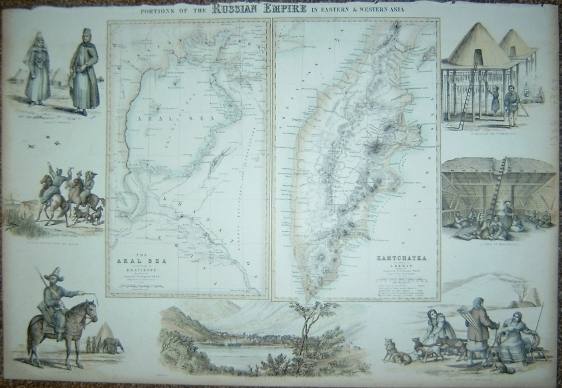
(Code No. 3397).
SWANSTON, G.H. & A. FULLARTON. (Antique Map)
"Portions of the Russian Empire in Eastern and Western Asia"
London & Edinburgh. A. Fullarton & Co. Size 12 1/2 x 18 1/2 inches. ca1860. Original steel engraved map with outline hand colour by A. Swanston. Showing two inset maps of Kamtchatka Peninsula and Aral Sea with vignette views of the people, natural history etc. £110.00
|

Click on picture above to view more images
How to order |
| (Code No. 3316)Johnston, Keith. (7 Antique Maps of India, China & Japan): "Japan & Korea", "Central Asia","China
& Japan", "2 x India ( Northern Sheet )", "2
x India ( Southern Sheet )"London. Edinburgh. Blackwood. ca1860, approx size, 19 x 14 1/2 ins
7 Hand-coloured in outline double page Asian maps by K, Johnston (all
loose, no text or covers). |
SOLD.
|
| (Code No. 3327)Johnston. W. & A.K. ( 5 Large-Scale Antique Maps of India, Asia,
Persia & China): "China and Japan", "Persia and Afghanistan", "India
Northern Sheet","India Southern Sheet" and "Asia".London. W. Blackwood & Sons. 1861. Page sizes 24 1/2 x 20 ins.
Hand-coloured in outline double page Asian maps engraved and drawn
by Keith. Johnston (all loose, no text or covers). Taken from Keith
Johnston's General Atlas. |
SOLD
|
|
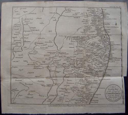
(Code no.2882)
Lodge. J. (Antique map.):
"An Accurate Map of the Coast of COROMANDEL from
the River Pennar to Pondicherri"
London. Bew. May 1782. Map image size 9 3/4 x 11 ins. Copper
engraved map by J Lodge. Compass indicator, A detailed map showing
roads, forts etc. £50.00
|
Click on picture above to view more images
How to order
|
|
(Code no. 2891)London. Bew. Dec 1782. Map image size 10 1/2 x
7 ins. Copper engraved map by J Lodge, slight off setting. Compass Rose, Scale line.
A detailed map showing roads, forts etc.
|
SOLD
|
(Code No.3021)
London.Size Approx 370 x 260mm. Original
engraved map with original outline hand colouring. Decorated border.Vg.
|
SOLD
|
Return to top
|
|