SITE CONTENT
Antique Maps & Prints
Britain
Antique Maps - World
Antique Books
Cartographers
Early Prints
Other Stock
|
| World Atlases and Maps |
Images |
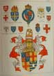
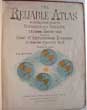
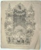
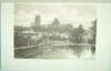
(Code No. 6887)
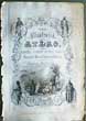
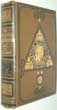
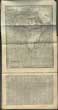
Tallis, John & John Rapkin.
(Antique title page).
Title Page for THE ILLUSTRATED ATLAS, AND MODERN HISTORY OF THE WORLD.
Date. (c.1850).
London & New York, J.Tallis. Page size [10 1/2 x 7 1/2ins]. Original steel engraved title page. Drawn and engraved by A Warren. Water stained to right side. Showing: - 4 Vignette scenes of the different races + a group of people in a rural setting......... £25.00 |
Click on picture above to view more images
How to order |
(Code No. 6854)
Guy, Joseph. .
Guy's School Geography, New and Easy Plan Comprising not only a Complete General Description but much Topographical Informantion. .....
Date. .(c.1818).
London, Baldwin and Cradock. 12mo [4 x 6ins] . Pp. 180 + (4) adverts + 6 of 7 folding World maps engraved and drawn by Russell & Son, very good condition.Original full calf. surface loss and splits. Sold as a collection of plates only......... £30.00 |
Click on picture above to view more images
How to order |
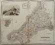
(Code No. 6672)Bowen, Emanuel and John Ogilby.BRITANNIA DEPICTA or OGILBY IMPROV'D.Date. 1720..London, Printed for, & Sold by Tho: Bowles Print & Map Seller Next ye Chapter House in St Pauls Church-Yard & Em Bowen next ye King of Spain in Katherins. 8vo.Title page + 53 of 54 ENGLISH and WELSH COUNTY MAPS, lacks East Riding of Yorkshire. Denbigh and Flintshire maps with outline colour, Cheshire reduced margin and Westmoreland map worm holes, including 1-53 strip maps of the roads, (at the back of each county map). Reduced from John Ogilby's road book Britannia of 1675.Thomas Bowles was competing with Gardener and Senex road maps books, he was determined to be first to publish, this led to him making many printing errors, corrected in the later editions. All maps loose....
|
SOLD.
|
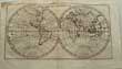
(Code No. 6589)Bacon. G, A.Longitude, Latitude and Zones.( Bacon's Excelsior Wall Map ).Date. [c.1920].London. G W, Bacon. Size 1000 x 755 mm. Folding to 335 x 250 mm. Folding linen backed coloured wall map, showing a World Twin Hemisphere above a World map on Mercator's Projection, with 6 circle globes, also shown railways, steamship routes of the various major shipping lines, eg, White Star and Orient line and other, towns and colour coded explanation in bold feature. Some slight marks & worm holes to the linen back ,not showing through to the map surface. ......
|
SOLD.
|
(Code No. 6588)
WRIGHT, Thomas.
The Royal Dictionary-Cyclopædia, for Universal Reference; being a complete literary, classical, historical, biographical, geographical, scientific and technological expositor of the English Language.
12 of 15 Divisions..
Date. [c.1860].
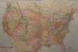
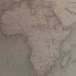
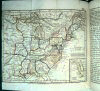
London Printing & Publishing Co. 4to, [7 1/2 x 10 ins.]..Pp. 480 per volume (approx) + 24 Steel engraved portraits + 11 Steel engraved views + 27 Steel engraved folding world maps, drawn and engraved by J Rapkin, some fold nicks no loss.. Maps shown:- Ireland, North Italy, Southern Italy, Africa, Australia, Asia, Asia Minor, British Isles, Scotland, France, Germany, Greece, Belgium, England & Wales, Europe, Denmark, Egypt, West Indies, World, U.S.A, (coloured), North America, Hemispheres, Channel Isles, British India, Turkey in Europe, Spain, Sweden & Norway, and New Zealand, marginal nicks to folds. Original cloth gilt. Rubbing & chipping. All holding firm....... £120.00 |
Click on picture above to view more images
How to order |
(Code No. 6573)Jenner, Thomas.A DIRECTION FOR THE ENGLISH TRAVILLER . . .Date. 1643.London: Jenner, Thomas..16mo, [5 x 5ins]. Pp. 3 + 39 English county maps, including 2 larger folding maps of England and Wales. a few spots to the margins & marginal split just affecting one image (1mm).The maps are in inclined position and squeezed into the triangular space below the distance table. They show rivers, towns (with the names spelt in full) and some hills. A pair of dividers measures off the new scale of 10 miles (= 7 /16ins.). It is thought the maps were originally produced at the orders of Oliver Cromwell, for the use of the Parliamentary Army in the English Civil War. Sir H. G. Fordham, however, considered that they were produced simply as a commercial venture of Thomas Jenner to meet an emergency demand. Original half calf, leather loss to spine.........
|
SOLD.
|
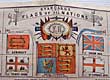
(Code No. 6513)
Brown, James.
Standard Flags of all Nations & Flags of the Royal Yacht Club and where Stationed.
(Large Antique Plan).
Date. [c.1860].
Glasgow; James Brown & Sons. 8vo, [4 x 7ins] folding out to [20 x 24 1/2ins].. Owner's book plate on front past down Original 21 sectional linen backed coloured plan of Standard Flags of all Nations & Flags of the Royal Yacht Club & others.
Listing:- Flags of the Royal Yacht Club, Flags of all Nations, yards and rigging, boat signals, distress and pilot signals, distant signals, semaphore, etc. owner's book plate on front past down..Original cloth gilt, faded and marked....... £150.00 |
Click on picture above to view more images
How to order |
(Code No. 6491)
Barclay, James.
A Complete and Universal English Dictionary: ..... but also, a Pronouncing Dictionary.
Date. 1814.
Liverpool: The Claxton Press, Nuttall. 4to, [8 x 11ins]. Pp. 964 + 26 World maps. 8 Maps with marks, (browning & foxing spots, etc), no loss. 18 maps, very good condition including the Asia & the 3 American maps. Original full reverse calf gilt. Splits to leather hinges. Holding firm. Heavy book....... £110.00 |
Click on picture above to view more images
How to order |
(Code No. 6483)Cole and Roper.THE BRITISH ATLAS; COMPRISING A COMPLETE SET OF COUNTY MAPS, OF ENGLAND AND WALES . ... . AND PLANS OF CITIES AND PRINCIPAL TOWNS.Date. 1810.London. Vernor, Hood and Sharpe; Longman Hurst....and other. Folio,[11 x 15ins]. Pp. [2] + 58 Hand coloured County maps of England and Wales + 21 Town plans. Shrewsbury town plan not published. All maps and plans in excellent condition..This atlas is the large paper edition with the County maps fully coloured. Original cloth gilt, hinge splits to top and bottom of spine. Holding firm.......
|
SOLD.
|
(Code No. 6439)
Smith, William. (Rouge Dragon).
The particular description of England : 1588 : with view of some of the chief towns and armorial bearings of nobles and bishops / Edited, from the original MS. in the British Museum, with an introduction by Henry B. Wheatley, and Edmund W. Ashbee.
Date. 1879.
London, Printed for Subscribers Only. 4to, [8 1/2 x 11 1/4ins]. Limited to 250 copies. Pp.xix, 72 [iv] + 30 Coloured prints. including 10 coloured maps & town plans + 18 coloured family coats of arms. Edited from the original MS in the British Museum, with an introduction by Henry B. Wheatley F.S.A. and Edmund W. Ashbee. F.S.A.. Quarter morocco gilt, rubbed with slight leather loss....... £150.00 |
Click on picture above to view more images
How to order |
(Code No. 6433)
SALMON. Thomas. 1679-1767.
The Modern Gazetteer: or, a Short View of the Several Nations of the World...
Date.1782, 10th edn.
London: E. Ballard and others.8vo, [5 x 7 1/2 ins]. Pp xliii + Not paginated, alphabetical listing + Genealogies and Families of the Several Emperors, Kings, etc + 7 FOLDIND WORLD MAPS by T. Kitchin. (1750 - 1759), World, (twin hemispheres), , Europe, Asia, Africa, North America, South America and Germany. Germany damaged, all other maps very good. Original full morocco/sheep? rubbed. Later calf spine gilt, rubbed..... £120.00 |
Click on picture above to view more images
How to order |
(Code No. 6351)
Cole, B.
Map of the World.
(Antique Map).
Date. 1760.
London: Stanley Crowder. Page size [12 x 7ins]. Original copper engraved folding map of the World, very good condition .....£50.00 |
Click on picture above to view more images
How to order |
(Code No. 6349)Bartholomew, J.G.The Century Atlas of the World, a series of 66 Maps with General Index and Geographical Statistics.Date. 1900. London, John Walker & Co. Folio, [11 1/2 x 15ins]. 66 Coloured World maps + Index, very good condition. Pictorial cloth, marked. Holding firm. ....
|
SOLD.
|
(Code No. 6294)J. PIGOT & CO.British Atlas: Countries of England, Comprising the Counties of England with Additional Maps of England and Wales, Ireland and Scotland and a circular one of the County round London....Date. 1837- 44.Manchester, L. Slater. Folio, [11 1/2 x 16ins]. Title + Pp 8 + 44 Tissue guarded hand-coloured steel engraved maps including 4 Large folding maps of England and Wales, Ireland and Scotland + A circular map of the County round London, light foxing to 4 maps, otherwise excellent condition. Each map decorated with a beautiful vignette engraving.Map Listing: - Topographical accounts, exhibiting the general statistics of each county; its ancient history, and modern localities, and divisions; commerce, manufactures, and population; tables of distances, etc. Original gilt decorated cloth, some rubbing and creasing.....
|
SOLD.
|
(Code No. 6279)The PRECEPTOR: Containing a General Course of Education......and advancing the Instruction of Youth in twelve parts.Illustrated with Maps and useful Cuts.Volume 1 of 2.Date. 1754, 2nd edn.London. R. Dodsley. 8vo, [5 x 8ins]. Pp. xlix, 5-466 + Engraved frontispiece + 21 of 23 folding engraved plates, frayed edges, three plates with slight loss. + 6 Folding hand-coloured world maps by Eman'. Bowen, very good. Original full calf gilt, leather splits. Holding firm. ..
|
SOLD.
|
(Code No. 6258)Bowen, Thomas & R. Brookes.The General Gazetteer or Compendious Geographical Dictionary.Date. 1778. London, J. F, and C. Rivington. 8vo, [5 1/2 x 8 1/2ins].Pp. xvi. Not numbered, (approx), 800 pages, some pages heavily browned + 9 Folding World maps.Showing:- World, North America, South America, Africa, Asia, England and Wales, Europe, France, and Germany. Original full calf gilt, surface loss and split hinges. Holding firm......
|
SOLD.
|
(Code No. 6220)BUFFIER Le Père, de la Compagnie de Jesus.Géographie universelle, exposée dans les differentes métodes qui peuvent abréger l'étude & faciliter l'usage de cette sience.Date. 1758.Paris: Pierre-Francois Giffart. 12mo, [ 4 x 6 1/2ins]. Pp. xvi, 416 + 17 Folding copper engraved World maps, very good condition. Maps Listed:- World, Europe, France, Switzerland, German Empire, Rhine, Italy, Spain, England, Scandinavia, Poland, Turkish Empire, Greece, European Asia, Asia, Africa & America. Showing 2 maps of America with California shown as an Island, (World & North America), 2 maps loose.The Island of California refers to a long-held European misconception, dating from the 16th century, that California was not part of mainland North America but rather a large island separated from the continent by a strait now known instead as the Gulf of California.The matter was settled beyond all dispute when the expeditions of Juan Bautista de Anza travelled between Sonora and the west coast of California 1774-1776. Original full calf gilt, rubbed.......
|
SOLD.
|
(Code No. 6197)
Bartholomew, John.
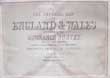
The Imperial Map of England & Wales According to the Ordnance Survey,
with the Latest Additions;shewing clearly every feature of the Country, Railways and their Stations, Roads, Canals, Rivers, Gentlemen's Seats, &c. &c.
Date. [c.1860].
London & Edinburgh. A. Fullarton & Co. Imperial Folio, [ 21 1/2 x !6ins ]. Hand coloured engraved 17 sectional maps of England & Wales. Showing Railways and their Stations, Roads, Canals, Rivers, Gentlemen's Seats etc. Scale of 4 ins to the Mile. Drawn and Engraved by John Bartholomew. Map size, (approx), 27 x 18ins. 3 Maps water stained to corners, nicks to blank margins throughout not affecting maps.. No Text or covers.......£90.00 |
Click on picture above to view more images
How to order |
(Code No. 6186)The Encyclopaedia Britannica.Volume. 34 only.(Map volume).Date.1903, 10th edn. Edinburgh, London, Adam and Charles Black. 4to [9 x 12ins]. Pp vii, 498. 124 Double page coloured world maps, including 66 double page coloured maps of separate American States. Decorated with piano key borders, most U.S.A. State maps with inset town plans. very good condition. Single sided. Half morocco gilt with raised spine bands and gilt decorated panel, lacks part of spine leather. Cloth boards, marked. Holding firm. Heavy book. (approx), 2.5kg......
|
SOLD.
|
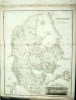
(Code No. 6178)
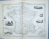
Fayard, A..
(Antique County/Department atlas of France.)
ATLAS NATIONAL
France General and Possessions.
Date. 1884 - 5.
Paris, F. Manelirer. Image size [7 1/4 x 10ins] to [10 x 16ins, double page]. Page size [12 x 9ins]. 127 Original steel engraved maps and town plans, original hand-colour with vignette views, all with French descriptive text, very good condition.
Some of the Counties/town plans shown:- Ain, Aisne, Ardennes, Ariege, Aveyron, Cantal, Charente, Charente-Infer, Cher, Creuse, Eure, Finistere, Gard, Garonne, Herault, Ille-et-vilaine, Indre, Isere, Jura, Landes, Liore, Loire (Haute), Lozere, Marne(Haute), Meurthe, Meuse, Nievere, Puy-de-Dome, Sathhe, Somme, Var, Vaucluse, Vienne, Vienne (Haute), Vosges, Yonne, etc. very good condition. Original half calf gilt, split leather hinges. Holding firm..... £150.00 |
Click on picture above to view more images
How to order |
(Code No. 6149)Hughes. William. (Ed).PHILIPS' COMPREHENSIVE SCHOOL ATLAS OF ANCIENT and MODERN GEOGRAPHY.Date. 1882. Liverpool, Philip & Son. 4to, [8 x 11ins]. Pp. 52, index + Engraved frontis, [principal rivers & mountains] + 57 Double page coloured World maps, including 18 Ancient World maps. Single sided, including double page folding twin hemisphere world map. Some light marking. Original half morocco gilt, slight rubbing.......
|
SOLD.
|
(Code No. 6146)Weller, Edward.(28 Loose Antique County Maps).English County Maps. (Compiled from the Maps of the Board of Ordnance and other surveys).Date. [c.1875].London, George Philip and Son. Page sizes [20 x 13ins]. 28 Original engraved county folding maps with hand-colour slight marginal nicks. Scale (approx), 1 inch to 2 miles. Showing railways and stations.English county maps listed :- 2 x Cumberland & Westmorland, (north & South) - Channel Islands - 2 x Lancashire, (north & South) - Huntingdonshire - Oxfordshire - Nottinghamshire - Northumberland - .Northamptonshire - Lincolnshire - Leicestershire & Rutlandshire - Cambridgeshire - 2 x Shropshire, (north & south) - Staffordshire - Suffolk - Sussex - Warwickshire - Hertfordshire - Northamptonshire - Orkney Islands & Shetland Islands - Derbyshire - 2 x Devonshire, (north & south) - Dorsetshire - Kent - Essex - Berkshire - Norfolk - Herefordshire - Cheshire. No Covers or Text.....
|
SOLD.
|
(Code No. 6143)Dugdale, Thomas.Curiosities of Great Britain England & Wales......6 Volumes.Date. [c.1845].London, J. Tallis. 8vo, [6 x 9 ins]. Pp 140 per volume, (approx) + Steel engraved frontispieces, foxing + Steel engraved title pages, foxing + (Approx), 250 Steel engraved views, foxing + 58 Double page engraved English & Welsh county maps by J. Archer, very good condition. Original cloth.. All holding firm........
|
SOLD.
|
(Code No. 6127)BAINES, Edward [1774-1848].2 Volumes bound up in 1.History of the Wars of the French Revolution, from the Breaking out of the War In 1792, to the Restoration of a General Peace In 1815, Comprehending the Civil History of Great Britain and France, During that Period.Date. 1817.London, Printed for Longman, Hurst, Rees. 4to, [8 1/2 x 10 1/2ins]. Pp. 539, 595 + 33 engraved plates including, 15 copper engraved portraits + 12 engraved maps, 4 folding by J. Neele. Original full reverse calf gilt, leather hinges split. Holding firm.......
|
SOLD.
|
(Code No. 6122)Bryce, James, 1838-1922. and others.The International Atlas and Geography: Modern, Historical, Classical and Physical......Date. [c.1870].London, William Collins Sons & Co. Ltd. .Large folio, [18.1/2 x 14.1/2 ins]. Pp. 156, [38 index] + 122 Printed colour engraved maps by John. Bartholomew, and E, Weller. Single sided maps, very good condition.Map list :- 60 Modern geography, including (19 America), 16 Historical, 14 Classical, 8 Railway maps, 4 Astronomical and 20 Physical geography. Original half morocco gilt. Raised spine spine bands gilt. marks and leather loss to top & bottom of spine. Gilt edges. Rare Atlas. Heavy item, 7.5kg. .......
|
SOLD.
|
(Code No. 6104)BARTHOLOMEW, J. G. (Ed.)The CITIZEN'S ATLAS of the World.Containing 120 pages of maps and plans with a descriptive gazetteer and geographical statistics.Date. [c.1898].London, George Newnes Limited. Folio, [10 1/4 x 14ins.] Pp. xxiv + 120 Printed coloured maps + 134 index, slight marginal splits to folds, (no loss), & slight marks. Original cloth gilt, lacks spine cloth, holding firm. Heavy book 3.2kg..........
|
SOLD.
|
(Code No. 6103)WOODWARD, Horace B.Stanford's Geological Atlas of Great Britain,[Based on Reynold's Geological Atlas], with Plates of Characteristic Fossils....Date. 1904.London , Edward.Stanford. 8vo, [6 x 7 1/2ins]. Pp. Lacks title, x, 139 + 33 of 34 Coloured geological British double page county maps, lacks Monmouthshire, very good + 16 black & white plates of fossils, very good. some pages loose, (perished gutta-percha}. Original cloth gilt, slight rubbing and closed cloth hinge split.......
|
SOLD
|
(Code No. 6088)Anon.The New National Encyclopedia Atlas.With an Alphabetical Index of the Latitudes and Longitudesof 30,000 Places.Date. 1868. London, William Mackenzie. 4to, 25 of 35 coloured engraved world maps, very good condition. Original gilt decorated cloth. All contents loose. Sold as a collection of maps only......
|
SOLD.
|
(Code No. 6075)
Landmann, George.
A Universal Gazetteer; or, Geographical Dictionary.
Date. 1840.
London, Longman. 8vo, Pp. Not numbered + 8 Folding steel engraved world maps, slight foxing.
Maps listed:- World, North America, South America, Asia, England, Europe, Ireland and Scotland,.Original half calf gilt. Rubbed & leather split to front hinge. Holding firm........ £60.00 |
Click on picture above to view more images
How to order |
(Code No. 6072)LIZARS, WILLIAM. HOME, (1788-1859).Lizar's Edinburgh Geographical General Atlas ... with a tabular view of the heights of the great mountain chains ... engraved upon sixty-nine plates.Date. [c.1846] .Edinburgh, W. H. Lizars. Folio, [13 x 19ins]. Pp. 16, index + 69 (i.e. 68), double-page maps hand-coloured in outline, + Steel engraved illustration + pp [2]. (Plate 32 omitted in numbering), slight centre fold dust marks + a few spots. Original half morocco gilt, front board detached, poor. Two maps showing the "REPUBLIC OF TEXAS".The Republic of Texas was an independent sovereign nation in North America which existed from March 2, 1836, to February 19, 1846. It was bordered by the nation of Mexico to the southwest and the Gulf of Mexico. Formed as a separate nation after gaining independence from Mexico in 1836, the republic claimed borders that included all of the present US state of Texas based upon the Treaties of Velasco, claiming the boundary as the Rio Grande. This dispute would later become a trigger for the Mexican-American War from 1846 to 1848.........
|
SOLD.
|
(Code No. 6062)
BELL, James.
A System of Geography, Popular and Scientific; or, A Physical, Political, and Statistical Account of the World and its various Divisions.
Date. 1838.
London: A. Fullarton and Co. 8vo, [6 x 9ins.] .. Volume 6, Part 2. Pp. v, 315-550, slight foxing spots + Steel engraved prints of Hobart Town, Van Dieman's land, (Australia) + 2 Folding maps of the Ancient World, and one folding map of the Pacific Ocean .Original cloth gilt, faded & splits to cloth. Holding firm.. ..... £35.00 |
Click on picture above to view more images
How to order |
(Code No. 6018)BUTLER Samuel.(15 Loose maps).An Atlas of Ancient Geography.Date. 1829.London, Longman, Hurst, Rees, Orme Brown and Green. 8vo, [6 x 8 3/4ins]. 15 Loose original hand-coloured maps from Buttler's Ancient Geography, engraved and drawn by S. Hall. No covers or text.Listing:- Orbis, Ancient Britannia, Hispania, Germania, Italia, Macedonia, Grecia, Syria, Africa, Albania, Oriens, Insulae, Peloponnesus, very good. ....
|
SOLD.
|
(Code No. 6007)HAMILTON, N.E.S.A National Gazetteer of Great Britain and Ireland;or A Topographical Dictionary of the British Islands.12 Volumes.London. Virtue & Co. 4to, [11 x 7 1/2 ins]. [c.1868]. Pp (approx) 240 per volume, ink plate list (volume 1), front past down + 68 English & Welsh, Scottish and Irish double page lithographic coloured county maps by W. Hughes, very good condition + 2 Steel engraved views. Original gilt decorated cloth, chipping with slight loss & faded, volume 12, spine & part of covers, badly faded. Weight of Books (approx) 11Kg........
|
SOLD.
|
(Code No. 5987)
The National Encyclopaedia.
A Dictionary of Universal Knowledge.
14 Volumes, complete.
Date. [c.1880].
London, William Mackenzie. 8vo. Pp. (Approx), 500 per volume + Total of 550 engraved prints, including, (approx), 48 coloured and a few uncoloured World Maps + (approx), 110 natural history prints + ( approx), 32 coloured prints + uncoloured misc prints, very good condition. Original decorated cloth gilt, very good condition.... Very heavy books...
Weight of 14 books = (approx), 22kg.
.....£130.00 |
Click on picture above to view more images
How to order |
(Code No. 5950)
Chambers, W & R.
Atlas of Modern and Ancient Geography for use in Schools and for General Reference.
Date. 1903.
Edinburgh. W & R Chambers. Folio. [13 x 10ins]. Title page + Contents + Index pp. 24 + 34 Double page & full page coloured maps by J. Bartholomew, very good condition, including twin hemisphere world map & 7 American maps. Original cloth gilt, lacks large part of upper cloth. Holding firm....... £50.00 |
Click on picture above to view more images
How to order |
(Code No. 5949)
Chambers, W & R.
Atlas of Modern and Ancient Geography for use in Schools and for General Reference.
Date. [c.1860].
London. William & Robert Chambers. Folio (9 1/2 x 12 ins). Pp (4) 23 + 34 World maps with original hand-colour in outline, drawn and engraved by J. Gallatly, slight marks to blank margins, vg. Original cloth gilt, boards detached. Lacks spine cloth..... £60.00 |
Click on picture above to view more images
How to order |
(Code No. 5912)COOK, Captain James.- Captains Portlock, Carteret, Wallis, Douglas, Saugnier, Rochon, Bligh, Edwards, Wilson, Lutwych, Anson, Drake, Bruce, Hodge, Patterson, Macartney & Wallace.Date. [c.1800].A Compilation of Travels and World Voyages. London, Folio, [10 x 15ins]. Pp. (approx) 800, (the pagination is not consecutive through the volume) + 41 Full page copper engraved prints + 12 Full page copper engraved maps/charts, trimmed closely, some light browning and staining, no list of contents, sold as is.Listing voyages to - Tahiti, New Zealand, Van Diemen's Land, America, Africa, India, Canada, etc. Original half calf gilt with raised spine bands, leather loss & leather hinge splits. Holding firm........
|
SOLD.
|
(Code No. 5870)BARTHOLOMEW, J. G. (Ed.)The CITIZEN'S ATLAS of the World.Containing 120 pages of maps and plans with a descriptive gazetteer and geographical statistics.Date. [c.1898].London, George Newnes Limited. Folio, [10 1/4 x 14ins.] Pp. xxiv + 120 Printed coloured maps + 134 index, slight marginal splits to folds & slight marks. Original cloth gilt, split to upper hinge, holding firm. Heavy book 3.2kg.......
|
SOLD.
|
(Code No. 5868)Bartholomew, J. G.The Comparative Atlas Physical & political.[Professor Meiklejohn's Geographical Series].Date. [c.1900]. 2nd edn, revised.London. A. M. Holden. 4to, [11 x 9ins]. Pp 27 + 64 Printed coloured world maps. Printed on both sides of each page. Two pages damaged. North America political & physical, Dominion of Canada and Polar Regions. One map split in centre fold. Atlas has 10 maps of America. Original cloth. Spine rubbed......
|
SOLD.
|
(Code No. 5852)Paterson's Roads.Direct and Principal Cross Roads in England and Wales with Part of the Roads of Scotland.Date. 1829, 18th edn.London. Longman, Orme Brown and others. 8vo, [6 x 8 1/2 ins]. Pp 715 + 44 (Appendix, across the River Severn, Chepstow Steam Ferry and an arranged Tour through Wales) + 9 Folding maps by Edward Mogg, (as listed), general map (loose & split with slight loss to margin). Original half calf, spine missing and front board detached.....
|
SOLD.
|
(Code No. 5850)Bartholomew, John.Fullartons' descriptive Hand-Atlas of the World.Bound in the original 15 parts.Date. 1871.London & Edinburgh, A. Fullarton. & Co. Folio, [10 x 14ins]. Pp. xii, 67 + pp. [8] Prospectus for the atlas + 25 Double page coloured world maps + 2 Single page coloured world maps, (as listed), each with descriptive text, very fine condition. Original printed decorated soft covers, slight fraying to hinges......
|
SOLD.
|
(Code No. 5849)NELSON, Thomas. Rev.A Classical Atlas,with a memoir on Ancient Geography......Date. [c.1830].Edinburgh; Alex. Macredie. 8vo, [5 1/2 x 8 1/2ins]. Pp. 16 + 22 Double page hand-coloured maps drawn and engraved by W. Murphy, foxing spots throughout & slight marginal splits to centre folds, no loss..A few marginal pencil annotations. Original printed boards, surface loss & later spine.......
|
SOLD.
|
(Code No. 5848)Hughes, William.The Treasury of Geography,Physical, Historical, Descriptive, and Political; Containing a Succinct Account of Every Country of the World......Date. 1878.London, Longmans ,Green and Co. 8vo, [4 1/2 x 7ins]. Pp. [10] , 892 + 7 Steel engraved World Maps, very good + 16 steel engraved view prints, very good. Original full calf gilt, slight rubbing........
|
SOLD.
|
(Code No. 5835)Lewis, Samuel.4 Volumes bound up in 2.A TOPOGRAPHICAL DICTIONARY OF ENGLAND,comprising the several Counties, Cities, boroughs........ and the Islands of Guernsey, Jersey and Man......A map of England .....A Plan of London and its Environs.Date. 1831.London, S. Lewis. 4to, [10 x 12 1/2ins]. Alphabetical listing + 45 Engraved English County Maps, including Large maps of London & England, (both split to folds, no loss.), some foxing throughout. Original half calf gilt, split to leather hinges and a rubbing. Holding firm. Heavy volumes.....
|
SOLD.
|
(Code No. 5831)
The Harmsworth Atlas and Gazetteer.
500 Maps and Diagrams in Colour with Commercial Statistics and Gazetteer Index of 105,000 Names.
Date. [c.1907].
London, Carmelite House. Folio, [11 x 16ins]. Pp. viii, 32, 284 + 210 Coloured world maps, UK and text page sections damaged and split to folds, slight loss and the South American map, damaged.. Original half morocco gilt, split to hinges and marked with slight loss. Heavy book. Sold as a working copy only....... £70.00 |

Click on picture above to view more images
How to order |
(Code No. 5830)Hammerton, J A, (Ed).Harmsworth's Atlas of the World and Pictorial Gazetteer with an Atlas of the Great War.Date. [c.1920].London. The Amalgamated Press Ltd. Folio, [10 x 15ins.] Pp. xii, 96 + 480 Coloured world maps & town plans, including text + 481 to 572 Coloured maps & town plans of the Great War, including text, very good condition. Original half morocco gilt, chipped, faded & slight split to hinge. Heavy book. Holding firm......
|
SOLD.
|
(Code No. 5817)
Fullarton, A.
The Parliamentary Gazetteer of England and Wales.
Volume 1 only of 12 .
Date. 1842.
Glasgow: A. Fullarton & Co. 8vo, [7 x 10 1/2 ins]. Pp xlix, 160. Steel engraved frontis, (London) + 3 Steel engraved English County Maps by R. Scott + England & Wales (folding map). Map listings :- Bedfordshire, Berkshire, Buckinghamshire, marginal foxing. 3 Maps with vignette views. Original embossed cloth gilt, spine faded...... £45.00 |
Click on picture above to view more images
How to order |
(Code No. 5816)Johnston, Alex. Keith.The Handy Royal Atlas of Modern Geography.Exhibiting The Present Condition of Geographical Discovery and Research in the Several Countries, Empires, and States of the World.Date. 1874, 2nd edn..Edinburgh. W & A K Johnston. Folio, [10 1/2 x 15 ins]. Title page + Dedication + Preface (2) + Contents + Index pp. 99, [1] + 45 Double page coloured world maps, (as listed), slight split to 5 folds, no loss. Engraved, printed and published by W & A. K. Johnston, including 8 American maps, South America has inset panel map of the Galapagos Islands + 4 Misc loose world maps. Original half morocco gilt with the Prince of Wales feathers on front cover. Raised spine bands gilt, rubbed and slight splits to hinges, still firm. All edges gilt...
|
SOLD.
|
(Code No. 5800)
Fullarton, A.
The Parliamentary Gazetteer of England and Wales,
Volumes 1, 2, 3 of 12 volumes.
Date. 1842.
Glasgow: A. Fullarton & Co. 8vo, [7 x 10 1/2 ins]. Pp lxi, 608. Steel engraved frontis, (London) + 12 Steel Engraved English County Maps by R. Scott. England & Wales (folding), Bedfordshire, Berkshire, Buckinghamshire, Cambridgeshire, Cheshire, Cumberland, Cornwall, Dorsetshire, Derbyshire, Devonshire, Durham. Some foxing (as usual). 10 maps with vignettes. Original embossed cloth gilt, spine faded, vg...... £80.00 |
Click on picture above to view more images
How to order
|
(Code No. 5784)Philips' Atlas of the British Isles.A series of 61 plates, comprising 51 maps of England and Wales, with complete index and 10 maps of Scotland and Ireland.Date. [1904].London : G. Philip & Son, Folio, [10 1/2 x 15ins]. Pp. [106, index], one page damaged + 60 of 61 Coloured British County maps, very good condition. Lacks Sussex County map, and the England and Wales map with marginal splits, no loss. Original cloth boards, faded and marked. Very rare British County atlas......
|
SOLD.
|
(Code No. 5782)
BROOKES. R. & A. PICQUOT.
General Gazetteer; or, Compendious Geographical Dictionary.
Date. 1826.
London. J. Rivington and others. 8vo, [6 x 9 ins]. Pp xvi. alphabetical listing, (not numbered), approx 400, very good contition. Twin Hemispheres of the World by Sidney Hall, (as listed), slight foxing, Modern morocco gilt with cloth boards, very good. ....... £60.00 |
Click on picture above to view more images
How to order |
(Code No. 5764)Quin, Edward.An Historical Atlas:in a series of Maps of the World as Known at Different Periods, Constructed upon an uniform Scale and Coloured according to the Political changes of each Period.Date. [c.1850], new edition.London: Richard Giffin. Large 4to, [12 x 14 ins]. Pp. (5), 114, (2) index + 15 Double page hand coloured engraved world maps + 6 large folding twin hemisphere world maps, ( Approx page size 39 x 26 ins ), some splits to folds, (no loss) and slight foxing and marks. Engraved and drawn by W. Hughes. Original boards, worn. Spine, missing. The large folding world maps in this new edition have been altered and updated to Twin World Hemisphers......
|
SOLD.
|
(Code No. 5755)Johnston, Alex Keith.General Geography.Date. [c.1850].Edinburgh, William Blackwood & Sons. 4to, [7 1/4 x 11ins]. Lacks title. Pp. 28 + 22 Coloured world maps, 3 maps with split to folds, no loss. Ink title on back of maps. Original half calf gilt, split to hinges. Holding firm. Sold as a collection of maps......
|
SOLD.
|
(Code No. 5754)Roberts, George.The Elements of Modern Geography & General History; on a Plan entirely New containing an accurate & interesting description of all the Countries, States &c., in the Known World ...Date. 1834.London, Printed for Whittaker & Co. 8vo, [4 1/4 x 7ins]. . Pp. xv, 479 + 10 Steel engraved World maps, slight marks + Engraved text view prints throughout + 4 Diagrams for the constructions of maps. Original half calf gilt, rubbed. Rare copy......
|
SOLD.
|
(Code No. 5742)Johnston. Keith.(Antique Atlas)The Royal Atlas of Modern Geography.Date1873Edinburgh. William, Blackwood & Sons. Royal Folio, [20 x 13 1/2 ins.] Engraved image size [22 1/2 x 17 1/2ins]. . pp. (4) + Half title (v. blank) + Title page (v. blank), marks + Dedication (v. blank) + Contents (v. blank) + 48 Double page World maps with outline colour, a separate index accompanying each map, a few maps with split to centre fold, no loss. Original half morocco gilt. poor. Holding firm.
|
SOLD.
|
(Code No. 5714)Keltie, J. Scott.The WORLD-WIDE ATLAS of Modern Geography Political and Physical: Containing One Hundred and Twenty Eight Plates and Complete Index.Date. 1912.London and Edinburgh ,W. & A. K. Johnstone Limited. 4to, [10 x 12ins]. Pp. xxv, 98, [2]. including Colour Frontispiece + 128 coloured world maps including town plans. Original cloth gilt, some slight surface loss.......
|
SOLD.
|
(Code No. 5679)Johnston, W & A.K.The World an Atlas.Date. [c.1876].Edinburgh and London : W. & A.K. Johnston. Printers to the Queen. 4to, [7 1/2 x 12ins].. Pp 46. 34 printed coloured double page world maps.Single sided. One ink spots on engraved area (England and Wales.) Some pencil notes and slight markes in blank margins. Original decorated embossed cloth gilt. Slight chipping and fading to spine...
|
SOLD.
|
(Code No. 5611)JOHNSTON, Alex. Keith.School Atlas of Physical Geography illustrating in series of original Designs, the Elementary Facts of Geology, Hydrography, Meteorology and Natural History.Date. 1858.Edinburgh & London, William Blackwood and Sons. 4to, [7 1/2 x 11ins]. Pp. 42, [4] + 19 Printed & engraved coloured maps by W & A. K. Johnston. Pencil annotations on the back of the some maps, not affecting the images. Original half morocco gilt, leather loss.....
|
SOLD.
|
(Code No. 5609)THE TIMES ATLAS.Containing 117 double and full-page colour printed maps, Comprising 173 maps and an Alphabetical Index to 130,000 Names".Date. 1896.London. The Office of the Times. Folio, [11.6 x 16.6 ins].. Pp. (112 index) + 117 double and full-page colour printed maps, nicks & splits to folds, slight loss to one map corner. Gilt- decorated half morocco, some leather loss. Gilt edges. Marbled end papers. Heavy book......
|
SOLD.
|
(Code No. 5599)Hall, Sidney, fl. 1817-1860 & William Hughes.General Atlas : Containing upwards of seventy maps, engraved on steel, in the first style of art ....New ed., embracing all the latest discoveries obtained from government surveys and expeditions, books of recent travel, and other sources.Date. 1854.Edinburgh : A. and C. Black. Folio, [13 x 17 1/4ins]. Pp. 12, [63 index], marginal nicks + 70 Steel engraved maps on 60 pages, some hand-colouring, a few splits to preliminary map folds (3ins) and some marks, no loss. Original half calf, rubbed with spine leather loss. Holding firm...
|
SOLD.
|
(Code No. 5580)
MEE, Arthur.
(Volume 10 only.)
The Children's Encyclopedia. (Atlas volume.)
No Date.
London, The Educational Book Company. 8vo. Pp. 6673-7382 + illustrations throughout including 38 coloured world maps on 31 pages + 43 English county maps on 22 pages, some with vignette views. Original half leather gilt, rubbed..... £45.00 |
Click on picture above to view more images
How to order |
(Code No. 5574)Harmsworth.Harmsworth's New Atlas.Date. [c.1920].London. The Amalgamated Press Ltd. Folio, [11 x 15ins.] Pp. xii,1-572. No title, as issued. + (Approx), 285+, coloured World maps with inset & full page town plans + Maps of World War One + Supplementary large folding single chart of the British Grand Fleet + Air raid map of the central London + Chart of the exact location in England & Scotland that suffered from hostile air raids and bombardments, (chart often missing). All maps with full page descriptive text. Original half morocco gilt, slight rubbing. Weight of book, (approx), 5kg......
|
SOLD.
|
(Code No. 5499)
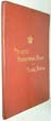
Philips’ Presentation Atlas for Young People, a series of physical and political Maps of all the countries of the World. Edited by J.F. Williams.
Date. [1890].
London , G. Philip & Son, 8vo, [9 3/4 x 7ins].Title + List of Plates + 64 Coloured World maps. Original cloth gilt, slight mark. Rare item..... £60.00 |
Click on picture above to view more images
How to order |
(Code No. 5403)Letts.Lett's Popular Atlas.Date. 1881London. Letts, Son & Co Limited. Folio, [9 1/2 x 14 1/2 ins]. Title + Preface + Contents, (maps in alphabetical order) + 61 Printed outline hand-coloured double page World maps on 34 pages. (as listed ) + pp.71, (index), the 2 large folding maps, (size 28 x 17ins,) with fold splits, (repaired, no loss). Original half morocco gilt, rubbing with some surface leather loss. Holding firm...
|
SOLD.
|
(Code No. 5395)Hughes, William.Philips' Student's Atlas of Ancient and Modern Geography, with a copious consulting index.Date. [c.1870.] London, George Philip, 4to, [7 1/2 x 11ins.]Pp. (1). [1-38, index, modern geography]. [pp. 39-46 index, ancient maps, frayed edges with some loss] + 49 engraved coloured World maps, (as listed). Original cloth gilt, later spine, marked. Retaining original title label, (upside down)....
|
SOLD.
|
(Code No. 5392)THE POPULAR EDUCATOR.4 Volumes, (complete).Date. [c.1870]. London. Cassell, Petter and Galpin. 4to, [8 x 10 ins].Pp. 412 per volume. Many woodcut illustrations throughout. 12 Half and full page engraved World Maps. Listing :- Acoustics, Astronomy, Botany, History, Architecture, Literature, Archeology, Ethnology, Geology, Physics, Physiology, Technology, very good condition. Original half calf gilt. Raised spine bands gilt, slight marks....
|
SOLD.
|
(Code No. 5386)Tytler, Alexander Fraser. (1747-1813)Elements of General History, Ancient and Modern. To which are added a Table of Chronology, and a Comparative view of Ancient and Modern Geography.Date. 1818 7th edn.London.Cadell & others. 8vo. 2 Volumes. Pp xvi 336. xii 482, vg. 6 Hand coloured folding world maps, vg. Including Modern America, Africa, Europe, Asia and Ancient "Italia Graecia & Asia" and " Orbis, Peteribus Notus". Original full calf gilt, slight rubbing. Hinge leather split, holding firm. Marbled edges.Tytler was appointed Professor of History at the University of Edinburgh in 1780 and was praised by Lord Cockburn for his 'elegant and judicious' lectures. He published several historical texts and a History of the Royal Society of Edinburgh (1787). He was a member of the group of contributors to The Mirror and The Lounger, and in later life he published several legal texts, edited a collection of the works of Allan Ramsay and wrote a life of Henry Home, Lord Kames....
|
SOLD.
|
(Code No. 5381)Chamber's Encyclopedia.A Dictionary of Universal Knowledge for the People.10 Volumes.Date. 1878.London & Edinburgh: W. & R. Chambers, 8vo, [7 x 10ins.] Pp. (approx) 800 per volume + 39 Coloured engraved World maps by W & A.KJohnston, very good condition. Original half calf gilt, some leather loss and splits & marked. All volumes holding firm. Heavy item.Johnston's first important work was the National Atlas of General Geography, which gained for him in 1843 the appointment of Geographer Royal for Scotland. Johnston was the first to bring the study of physical geography into competent notice in England. His attention had been called to the subject by Alexander von Humboldt; and after years of labour he published his magnificent Physical Atlas in 1848, followed by a second and enlarged edition in 1856. This, by means of maps with descriptive letterpress, illustrates the geology, hydrography, meteorology, botany, zoology, and ethnology of the globe. The rest of Johnston's life was devoted to geography. His services were recognised by the leading scientific societies of Europe and America...
|
SOLD.
|
(Code No. 5342)Hammerton, J.A. (editor).Harmsworth's New Atlas of the World and Pictorial Gazetteer with an Atlas of the Great War.Date. [c.1918.]London: Amalgamated Press, Folio, [10 x 14 1/2ins.] Pp.xii, 93, index + 485 Coloured maps & plans. Most World maps have an appropriate inset town plan. Original cloth gilt, rubbed & slight chipping. Weight of book, (approx), 4.8Kg.
|
SOLD.
|
(Code No. 5325)
Johnston, Ruddiman.
The RELIABLE ATLAS an Entirely New Atlas ....Chart of Astronomical Diagrams. 33 Modern Political Maps.
Date. [c.1880].
London, Ruddiman Johnston & Co. Folio, [15 1/4 x 12ins.] No Title + 34 Maps and 4 printed colour with some hand-colouring, Astronomical Diagram, etc, index pp.14, some marginal nicks, no loss. Original decorated cloth, faded & boards detached. Rare atlas. £110.00 |
Click on picture above to view more images
How to order |
(Code No. 5321)
Anon.
9 Loose hand-coloured manuscript World maps. British.
Page size [13 1/2 x 10ins.] Image sizes 10 x 8ins to 7 x 6ins, (approx).
No Date, [c.1900.]
9 Beautiful loose hand-coloured and drawn World maps. Maps listed :- Europe, Australia, Palestine, South America, Holland & Belgium, Chinese Empire & Japan, England, Scotland and Ireland, very good condition. £100.00 |
Click on picture above to view more images
How to order |
(Code No. 5292)Dugdale, Thomas.Curiosities of Great Britain England & Wales.8 Volumes, (Complete).Date. [c.1845]. London. J, Tallis. 8vo, [6 x 9 ins]. Pp. 200 per volume, (approx), lacking pp.164 to 205, (publishing error), (unread, most text pages still uncut) + 8 Steel engraved frontispieces + 8 Steel engraved title pages, foxing + 175 Steel engraved views, with tissue guards, slight foxing + 61 Double page engraved English & Welsh county maps, with out line hand-colour, by J Archer, ( including 3 extra duplicate county maps :- Cornwall, Cumberland & Derbyshire, binding error), slight foxing. Original cloth gilt, rubbing, splits to cloth hinges. All volumes holding firm.
|
SOLD.
|
(Code No. 5284)
Brookes, Walker & Cruttwell.
2 Volumes.
NEW UNIVERSAL GAZETTEER; OR COMPENDIOUS GEOGRAPHICAL DICTIONARY.....
Date. 1812.
Manchester, Russell & Allen. 8vo, [5 1/2 x 8 1/2ins.]Pp. xxiii, not numbered, approx, pp. 500 per volume. 14 of 15 folding engraved world maps. Map list :- Lacking world map - Netherlands, splits and repairs, no loss - Scotland, splits and repairs, no loss - Spain, splits and repairs, no loss - Africa - U.S.A, slight damage no loss - South America - Asia, damaged with loss - England damaged with loss - Europe - France - Germany, split to fold - Europe, northern States - West Indies - Italy. Modern quarter morocco gilt. £85.00
|
Click on picture above to view more images
How to order |
(Code No. 5283)Brookes, R.The General Gazetteer, or Compendious Geographical Dictionary.......Date. 1802, 12th edn.London, J.Johnson...8vo, [5 1/4 x 8 1/2ins.] Pp. xvi, not numbered, approx pp. 800, 9 leaves with frayed edges + 7 of 8 copper engraved world maps by B. Baker, lacking world map, some foxing + Copper engraved World map from another edition. Map list : - World, (from another edition), Africa, South America, North America, Asia, Europe, East Indies, (showing northern Australia), and the West Indies. Original half calf, rubbed.
|
SOLD.
|
(Code No. 5218)Harmsworth Atlas and Gazetteer.500 Maps and Diagrams in Colour with Commercial Statistics and Gazetteer Index of 105,000 Names .Date. [c.1906.] London, Published at Carmelite, Folio, [11 1/2 x 16ins.] Pp. viii + 210 coloured world maps, some slight split to folds, no loss + Pp. 283 [index and world commerce], slight marks to outer margins not affecting text. Original cloth gilt, marked & split to cloth hinge. Holding firm..
|
SOLD.
|
(Code No. 5200)
HAMILTON, N.E.S.A
National Gazetteer of Great Britain and Ireland; or A Topographical Dictionary of the British Islands.
Volume 1 of 3. Section A-E.
Date. 1868.
London. Virtue & Co. 4to, [11 x 7 1/2 ins]. Pp. 932 + 17 English double page lithographic coloured county maps & UK general maps + 4 Scottish double page lithographic coloured county maps + 1 Irish double page lithographic coloured county map + 1 Atlantic double page lithographic coloured map by W. Hughes, some foxing spots throughout & Berkshire map frayed at the edges not affecting image. Original half calf gilt, rubbed. £45.00 |
Click on picture above to view more images
How to order |
(Code No. 5188)Milner,Thomas Rev.The Gallery of Geography a Pictorial and Descriptive Tour of the World.Volume 2 only of 2 volumes.Date. . [c.1875].Glasgow. W. R. M'Phun & Son. 4to, [7 1/2 x 10 ins] Pp. 511-956 + 3 Full page steel engraved plates, including bird's eye views of New York, Mexico City and Sydney.+ 6 Double page world maps, 2 maps with splits to folds and some marginal foxing +(Chromolithographs), some marginal foxing. Original half morocco gilt. Raised spine bands gilt, rubbed.
|
SOLD.
|
(Code No. 5148 MG )Ellis, J.ELLIS’S ENGLISH ATLAS . . A Compleat Chorography of England and Wales in Fifty Maps.........Date. 1768. London. Printed for ROBERT SAYER No. 53, IN FLEET STREET. Oblong 4to, [11 x 9ins.] Engraved title + List of Maps + 50 Copper engraved English & Welsh County Maps, plain backs, as published. Cornwall cropped. Title states fifty maps. "Map list" calls for 52 maps. No maps cut out. Original half calf over marbled boards, slight rubbing. Rare Copy.
|
SOLD.
|
(Code No. 5129)Gross, Alexander.The Daily Telegraph Victory Atlas of the World .Date. [c.1920]London, Geographia Ltd. Large folio, [15 x 23ins.] . 284 coloured world maps on 150 pages, all maps in very good condition. Original half morocco gilt, some loss and wear.. Heavy Book.
|
SOLD.
|
(Code No. 5100)Martin, R. Montgomery (Robert Montgomery), 1803?-1868.THE BRITISH COLONIES; Their History, Extent, Condition, and Resources......4 of 5 Volumes. Lacks volume 5.Date. [c.1850.]London & New York, J & F Tallis, 4to, [8 x 11ins.]
Approx, 380 pages of text per volume + 29 Double-page steel engraved Tallis maps, with original outline hand-colour & decorated with vignette views, very good condition + 28 Full-page plates, very good condition.List of Maps.Vol 1- World on Mecartor's Projection, Western Hemisphere, British America, North America, Nova Scotia or Newfoundland, Canada or New Brunswick, West Canada,Vol 2- Australia, Western Australia & Swan River, Part of South Australia, Victoria or Port Phillip, New South Wales, Eastern Hemisphere.Vol 3- Polynesia Islands in the Pacific Ocean,Van Diemen's Land or Tasmania, Falkland Islands, The World, New Zealand.Vol 4- Africa, slight damage, Western Africa, Natal and Kaffraria, Cape Colony, Jamaica, West India Islands, Islands in the Atlantic, South America, Central America, British Ghayana, Isthmus of Panama.Original half calf gilt, raised spine bands with gilt-decorated panels, rubbed with some slight surface loss.
|
SOLD.
|
(Code No. 5104) JOHNSTON, Alex. Keith. A School Atlas of Physical Geography, Illustrating, in a series of original Designs, the elementary facts of Geology, Hydrology, Meteorology, and Natural History.Date. 1858. Edinburgh, Blackwood, 4to, [7 1/2 x 11ins.] Pp. 23 + 19 World maps, engraved and printed in colour by W.& K. Johnston, very good. Original half morocco gilt, rubbed with surface loss to spine leather.
|
SOLD.
|
(Code No. 5098)Philip, George.Philips' Atlas of the Counties of England, including Maps of North & South Wales, The Channel Islands and the Isle of Man.Date. [c.1885].London, George Philip and Son. Folio, [11 x 15ins]. Pp. (106 Index, some pages damaged with some loss) + 48 Chromolithograph, (printed colour), county maps, Yorkshire S/E, Warwickshire and Devonshire, damaged with loss. Other maps with some nicks to outer edges and centre folds, no loss. Small library stamp on back of all maps not affecting images. Half morocco gilt, poor. Sold as a working only.
|
SOLD.
|
(Code No. 5077)
Brookes, R, M.D. & A.G. Findlay.
THE GENERAL GAZETTEER in Miniature.
Date. 1843.
London,Thomas Tegg, 12mo, [4 1/2 x 6ins].. Pp. xii, 774, 10 + 5 folding World Maps, very good condition. Original cloth gilt, slight split to upper hinge. £55.00
|
Click on picture above to view more images
How to order |
(Code No. 5066)
BELL, James.
A System of Geography, Popular and Scientific; or, A Physical, Political, and Statistical Account of the World and its various Divisions.
Date. 1845.
Volume 1, Part 1.
London: A. Fullarton and Co. 8vo, [6 x 9ins.] Pp. 320 + 2 Steel engraved prints of Windsor Castle & Syracuse + 3 Folding maps of the Twin Hemisphers, Switzerland and West Indies, Image sizes, (approx), 13 1/2 x 7 and 9 x 71/2ins. Original cloth gilt, faded. £40.00 |
Click on picture above to view more images
How to order |
(Code No. 5050)
ARROWSMITH, Aron, the Younger.
A Grammar of Modern Geography with an introduction to Astronomy and the use of Globes.
Date. 1832.
London, S. Arrowsmith. 8vo, [4 1/2 x 7ins]. . Pp. 463 + 26 outline hand-coloured world maps + 2 Astronomical charts, a few maps with split in the folds and edges. Europe and German map, damaged. Original full calf with modern leather spine. £170.00 |
Click on picture above to view more images
How to order |
(Code No. 5049)
Reid, Alexander.
Rudiments of Modern Geography with an Appendix.
Date. 1859.
Edinburgh, Oliver & Boyd. 12mo, [4 x 6 1/4ins]. Pp. 122 + 2 Engraved maps one folding + 2 Engraved plates. Original full calf, some loss to spine leather. £35.00
"Published price 1s, or with 5 maps,1s 3d". |
Click on picture above to view more images
How to order |
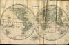
(Code No. 4997)Tallis, John & J, Rapkin.(2 Antique Maps.)A Comparative View of the Principal Waterfalls, Islands, Lakes, Rivers and Mountains in the Eastern Hemisphere + Western Hemisphere.London. John Tallis & Co. Page sizes, [10 3/4 x 15 ins.] [c,1850.] 2 Original steel engraved maps, drawn and engraved by John Rapkin. Taken from "Montgomery Martin's Illustrated Atlas"
|
SOLD.
|
| (Code No. 4983)Bacon, G W.Bacon's Popular Atlas of the World.Date. 1894. London, Bacon & Co Ltd, Folio, [11 x 14ins.] Pp. [v], [82] + 50 Coloured world maps including 2 diagrams, slight fold splits, a few affecting the engraved area. Maps with inset town plans. Original cloth gilt, cloth hinges split, holding firm.
|
SOLD.
|
| (Code No. 4962)Martin, R. Montgomery (Robert Montgomery), 1803?-1868.THE BRITISH COLONIES; Their History, Extent, Condition, and Resources......5 Volumes, (Complete).Date. [c.1850.] London & New York, J & F Tallis, 4to, [8 x 11ins.] 40 Double-page steel engraved Tallis maps, (as listed), with original outline hand-colour & decorated with vignette views, very good condition + 31 Full-page portraits + 8 Full-page views, very good condition. List of Maps. Vol 1- World on Mecartor's Projection, Western Hemisphere, British America, North America, Nova Scotia or Newfoundland, Canada or New Brunswick, West Canada,Vol 2- Australia, Western Australia & Swan River, Part of South Australia, Victoria or Port Phillip, New South Wales, Eastern Hemisphere.Vol 3- Polynesia Islands in the Pacific Ocean,Van Diemen's Land or Tasmania, Falkland Islands, The World, New Zealand.Vol 4- Africa, Western Africa, Natal and Kaffraria, Cape Colony, Jamaica, West India Islands, Islands in the Atlantic, South America, Central America, British Ghayana, Isthmus of Panama.Vol 5- Asia, Overland Route to India, Thibet, Independent Tartary, British India, Southern India, Northern India, Cabool the Punjab and Beloochistan, Ceylon, Malay Archipelago, British Possessions in the Mediterranean.Original half calf over marbled boards, rubbed with some slight surface loss.
|
SOLD.
|
| (Code No. 4908)
BELL, James.
A System of Geography, Popular and Scientific; or, A Physical, Political, and Statistical Account of the World and its various Divisions.
Date. 1845.
Volume 1, Part 2.
London: A Fullarton and Co. 8vo, [6 x 9ins.] Pp.331-624, unopened + 3 Steel engraved prints of Egypt, Constantinople and Damascus + 4 Folding maps of Denmark, Brazil and Prussia and The principal mountains, (Image size 9 x 7 1/2ins, approx), slight foxing. Original cloth gilt. marked and faded spine. £40.00
|
Click on picture above to view more images
How to order |
(Code No. 4879)BELL, James.A System of Geography, Popular and Scientific; or, A Physical, Political, and Statistical Account of the World and its various Divisions.Date. 1846.London: A Fullarton and Co. 8vo, [6 x 9ins.] Volume 3, Part 1. Pp. 288 + 2 Steel engraved prints of Jerusalem & London + 3 Folding maps of India, U.S.A and Colombia, (Image size 9 x 71/2ins), waterstained & marked. Original cloth gilt, faded. Working Copy only.
|
SOLD.
|
(Code No. 4826)Leigh. S.Leigh's New Pocket Road-Book of England and Wales + Leigh's New Atlas of England & Wales.2 Volumes bound up in 1.Date. 1825, 2nd edn.London. Samuel Leigh. 16mo, [3 1/2 x 5 1/2ins.] Pp. iv, 404 including, 55 Miniature English & Welsh copper engraved County Maps, (as listed), very good + Folding copper engraved general map of England & Wales, slight split to fold. Original full calf gilt, some surface loss & later spine leather.
|
SOLD.
|
| (Code No. 4857)Bartholomew, John:The Royal Atlas of England and Wales reduced from the Ordnance Survey.Date. [c.1890].London. G.Newnes. Folio, [ 10 x 14 1/2 ins ]. Pp xii, 72 (index), including title page (as above) and Contents, 2 leaves taped + 50 Double-page printed coloured maps, very good condition, lacking general map of England & Wales + 27 Printed colour town plans on 19 sheets + 2 Extra large linen backed folding plans of the Diocese of Lichfield & Town plan of the City of Canterbury,1860, slight surface loss. Original half morocco gilt, badly worn, Holding firm......
|
SOLD.
|
(Code No. 4851)Walker, J. and C.Hobson's Fox-Hunting Atlas; containing Seperate Maps of Every County in England, and the Three Ridings of Yorkshire; comprising Forty-Two Maps, showing the Roads, Railways, Canals, Parks, etc.Date. [c.1870.]London. J. and C. Walker. Folio, [10 x 15ins.] 42 Original hand-coloured English County foxhunting engraved maps, showing over 100 hunts. Published as a foxhunter guide. Printed by county with clearly coloured boundaries with the hunt's individual named meets, coverts and kennels. Original gilt-decorated half-morocco with raised spine bands, slight rubbing......
|
SOLD.
|
| (Code No. 4844)The New Popular Educator : A Complete Encyclopaedia of Elementary and Advanced Education : Special Edition.8 Volumes, Complete.Date. [c.1880].London, Cassell. 8vo, [7 x 9 1/2ins.] [c Pp 380 per volume, (approx) + 16 engraved plates, (various) + 19 chromolithographic, (colour printed), prints, (various) + 26 coloured World maps engraved by F.S. Weller + 17 coloured engraved maps of the UK cities and their environs + 2 Star charts, (as listed), all very good. Original cloth gilt, slight rubbing and marks. Heavy books.
|
SOLD.
|
| (Code No. 4842)
Fisher's County Atlas.
Part 5, GLOUCESTERSHIRE & OXFORDSHIRE.
Date. [c.1840.]
London. Fisher, Son, & Co. Folio [12 1/2 x 15 ins] Original steel engraved hand coloured GLOUCESTERSHIRE map, foxing + Original steel engraved hand coloured OXFORDSHIRE map, foxing. Original decorated soft cover title, badly marked. £50.00 |
Click on picture above to view more images
How to order |
| (Code No. 4819)Johnston, Alex Keith.The Handy Royal Atlas of Modern Geography Exhibiting the Present Condition of Geographical Discovery and Research in the Several Countries, Empires and States of the world.Date. 1868.Edinburgh. William Blackwood and Sons. Folio [15 x 10ins.] Pp 98,(index) + 45 Steel engraved World maps with outline hand colour, scattered foxing spots throughout & a few splits to folds + 10 Loose duplicate maps, very good. Original half morocco gilt, lack part of spine leather & split hinges. Holding firm. Alexander Keith Johnston (1804 - 1871) was a Scottish geographer. He was born at Kirkhill near Edinburgh. After an education at the high school and the University of Edinburgh he was apprenticed to an engraver; his interest in geography had developed early, and in 1826 joined his brother in a printing and engraving business, forming the well-known cartographical firm of W. and A. K. Johnston.
|
SOLD.
|
(Code No. 4802)Philip. George, (ed).Philips Select World Atlas of Physical and Political Geography.Date. 1902.London. George Philip & Son. 4to, [7 1/2 x 11ins]. Pp 42, (index) + 40 Coloured world maps, (as listed) + Large loose folding Stanford's coloured map, (14 x 22ins), of South Africa, showing German East and South West Africa to Natal & Cape Colony. Original gilt-decorated cloth.
|
SOLD.
|
| (Code No. 4785)John Bartholomew, Revised by P. W. Joyce.Philips' Handy Atlas of the Counties of Ireland.Date. 1888. London. George Philip & Son. 8vo, [5 x 7 1/4 ins].Advert + Title (as above) + Contents + 33 Coloured Irish county double page maps + pp. 41 Index. Original gilt - decorated cloth, slight rubbing.
|
SOLD.
|
| (Code No. 4732)Asprey's Atlas of the World & Gazetteer of the World.2 Volumes.Date. Nov, 1912.London, Asprey & Co. 12mo, [3 1/2 x 5ins.] Pp xxxi + 145 colour printed world maps including 170 maps and Diagrams with a Geographical and Statistical Summery. Original half morocco gilt, split hinges and rubbed. Holding firm.
|
SOLD.
|
| (Code No. 4687)
Prideaux, Humphrey, D.D. (Dean of Norwich)
THE OLD AND NEW TESTAMENT Connected in the History of the Jews and Neighbouring Nations, from the Declension of the Kingdoms of Israel and Judah to the Time of Christ.
Date. 1717-18, 3rd edn.
London. Printed for R. Knaplock & J. Tonson. Folio, 9 1/4 x 13 1/2ins. Pp. xxvi, 453, [15] . xviii, 518, [62] + 5 Copper engraved maps + Plan of a temple and text illustration, very good condition. £300.00
Maps shown :- Palestina seu Terra Sancta, Syria, Aegyptus et Cryenaica (Egypt), Oriens Persia India and Asia Minor, very good condition. Original full calf gilt with raised spine bands, worn and front and rear boards detached. |
Click on picture above to view more images
How to order |
(Code No. 4675)Johnston, Alexander Keith.(Antique World Map.)Chart of the World on Mercator's Projection.Date. 1849.Glasgow and Edinburgh. W and A.K. Johnston. Image Size 23 x 19ins. Page size 26 x 21ins. Original steel engraved World Map with out line hand colouring, Tasmania still called Van Diemen Land. Taken from "The National Atlas of Historical, Commercial and Political Geography"
|
SOLD.
|
| (Code No. 4652)Tooley, R. V. (Ronald Vere), 1898-1986.A Dictionary of Mapmakers.Date. 1979. London. Map Collectors’ Circle, 4to. Pp xii 684, very good + Plates & Maps. Original cloth gilt. Dust Jacket, very good.Approx 27.000 named mapmakers and their works, etc, listed.
|
SOLD
|
(Code No. 4593)Bartholomew. John, (1860-1920.)The Survey Atlas of England and Wales, A Series of Eighty Four Plates of Maps and Plans…..Date. 1903.Edinburgh, Royal Geographical Society. Folio, [18 x 13 ins]. Half title +Title (as above) + Preface + List of plates + Contents + Dedication + Editor's Notes + pp. 1-27 Text + 11 General coloured maps showing the physical features, geology, climatologic, population, and political divisions of the country + 66 Coloured ordnance survey maps covering the whole of England and Wales, scale 2 miles to 1in + 16 Town plans on 16 sheets, drawn, engraved, printed and published by the "The Edinburgh Geographical Institute", maps in very good condition. Original cloth, faded and repaired hinges. Holding firm. All edges gilt.One of the first bound atlases in this modern format, previously atlases of England and Wales were shown as a series of individual counties. Weight 10.5Kg.
|
SOLD.
|
(Code No. 4562) WRIGHT, Thomas: The Royal Dictionary Cyclopaedia for Universal reference. Biographical, Classical, Literary, Scientific, Geographical, and Technological. 15 Volumes, (complete)..London Printing & Publishing Co. 4to, [7 1/2 x 10 ins.] Pp. 480 per volume (approx) + Engraved title + 27 Steel engraved portraits + 14 Steel engraved views + 32 Steel engraved folding world maps,some slight centre fold splits, (Map of America hand coloured, as issued), drawn and engraved by J Rapkin + 10 Misc engraved plates. Original blind stamped cloth with gilt-decorated spine, some chipping and 3 cloth splits at hinges. All volumes holding firm.
|
SOLD.
|
(Code No. 4561)Collier, William F and Leonhard, Schmitz.THE INTERNATIONAL ATLAS, Consisting of Seventy Maps: Forty of Modern Geography, and Thirty of Historical and Classical Geography with Descriptive Letterpress of Historical Geography, and of Classical Geography.Date. [c1870.]London. William Collins. 4to, 8 x 10 3/4ins. Pp. 15, 28, 55 + 62 engraved coloured world maps, (as listed), a few nicks to margins and a few splits to centre folds. Original decorated cloth gilt, rubbed and chipped to top and bottom of spine.
|
SOLD.
|
(Code No. 4556)Curiosities of Great Britain. England & Wales Delineated; Historical, Entertaining & Commercial, alphabetically arranged -Volume I only.Date. [c.1840].London. (J Tallis). 8vo, 5 1/2 x 9ins. Pp 580. + 12 Steel engraved maps by J. Nightingale, (not John Archer maps), some offsetting and marks + 73 steel engraved views, including 4 plans, Maps shown - 2 x England and Wales, Bedfordshire, Berkshire, Brecknockshire, Buckinghamshire, Cambridgeshire, Cardiganshire, Caernarfonshire, Cheshire, Cornwall and Cumberland. Original half calf, poor with front cover missing.
|
SOLD
|
(Code No. 4515)Camden (William). Piggott. Stuart, Prof, (introduction).
Camden's Britannia 1695.A Facsimile of the 1695 Edition.(ISBN: 0723000166)London. Times Newspapers & David and Charles. 1971, reprint. Folio, 10 x 16ins. Pp. 1116, [44, annals of Ireland + index] + 50 Facsmile double page British county maps by Robert Morden + Many illustrations. Original cloth gilt. Fine copy. Please email for postal rates. Weight of atlas 4.3k, (approx).
|
SOLD.
|
(Code No. 4510)Bartholomew. John.The Oxford Physical Atlas. By J.G. Bartholomew.Date. 1936.London. Oxford University Press. Folio, 10 x 15ins. Pp. 32 + 95 of 96 coloured World maps, lacking British Isles map, (political), some slight marginal pencil notes, very good condition. Original quarter morocco gilt, slight chipping. Cloth boards, marked with slight loss. Rare Copy.A special edition for Selfridge and Company.
|
SOLD.
|
(Code No. 4496)Bartholomew, John.The Royal Atlas of England and Wales reduced from the Ordnance Survey.Date. ca1897.London. G.Newnes. Folio, [ 10 x 14 1/2 ins ]. Pp xii, 72 (index,) including title page (as above) and Contents + 51 Double-page printed coloured maps, very good condition + 27 Printed colour town plans on 19 sheets, very good condition.. Original half morocco gilt, rubbing with some surface loss.
|
SOLD.
|
(Code No. 4445)CRUCHLEY, George.Cruchley’s County Atlas or England & Wales, shewing all the Railways & Stations with their names, also the Turnpike Roads and Principal Cross Roads, delineated on a series of 46 County Maps.Date. 1875London. G.E. Cruchley. 8vo, [6 1/2 x 9 1/4ins.]. 47 Hand coloured lithographic English and Welsh County Maps. All but 9 maps split at the centre fold. Original cloth gilt, stitched repair to the hinges. Sold as a Working Copy only.
|
SOLD.
|
(Code No. 4426)Harmsworth.Harmsworth's New Atlas.Date.
ca1920.London. The Amalgamated Press Ltd. Folio, [11 x 15ins.] Pp xii,
572. No title, as issued. (Approx), 285 coloured World Maps with inset
town plans, including maps of World War One. All maps with full page descriptive
text. Original cloth, rubbed. Weight of book, 5kg.
|
SOLD
|
(Code No. 4424)Speed. John.Title Pages.(The Second Book containing the Principality of Wales.)Date. 1676.London. Basset and Chiswell, Page size 11 1/2 x 17 ins. Pp. 95 to 98. Original copper engraved title pages to the Welsh section of John Speed's "The Theatre of the Empire of Great Britaine" Guaranteed to be over 300 years old.
|
SOLD
|
(Code No. 4423)Speed. John.Title Pages.(The Second Book containing the Principality of Wales.)Date. 1611, 1st edn.London. Printed by William Hall for Sudbury and Humble. Page size 10 1/2 x 18 ins. Pp. 95 to 98. Original copper engraved title pages to the Welsh section of John Speed's "The Theatre of the Empire of Great Britaine"
|
SOLD.
|
(Code No. 4422)TYMMS, Samuel.The Family Topographer.Date. 1837-38.London. J.B.Nichols & Son, 12mo, [4 1/2 x 7ins.] Pp. 39 & Map of Cumberland + pp. 28, & Map of Westmoreland + pp. 43, & Map of Lancashire + pp. 27 & Map of North Riding (Yorkshire) + pp. 30-51 & Map of East Riding (Yorkshire) + pp. 53-96 & Map of West Riding (Yorkshire). All maps engraved by Nichols, J. B. & Son, very good condition. Part unopened. Text and maps only, no title pages or covers.
|
SOLD.
|
(Code No. 4408)Scott. J. and Edward. Khull.THE GLASGOW GEOGRAPHY Containing a Physical Political and Statistical View of the Various Empires Kingdoms States of the Known World.No date ca1825.Glasgow. Edward. Khull. 4to, [8 1/2 x 11ins]. Contemporary hand written map list. 33 of 34 Steel engraved world maps, marginal nicks and some foxing, a child's pencil and ink marks on back of some maps, affecting one map's surface. Lacking North American map.Original half calf gilt, rubbed with split to hinges. Holding firm.Australia listed as New Holland. This atlas volume is collected from a 5 Volume work on philosophy, universal history, astronomy, mineralogy, etc.
|
SOLD.
|
(Code No. 4398)Goldsmith, J. Rev.A Grammar of General Geography for the use of Schools and Young Persons.Date. ca1850.London: Longman, Brown, Green & Longmans, 12mo, [4 1/2 x 6 1/2 ins.] Pp viii, 335, (16,adverts) + Revolving world time zone disc frontis + 10 Folding steel engraved world maps by S. Hall, (one full page print with 2 maps) + 9 Full page steel engraved plates. Original cloth gilt, slightly rubbed.
|
SOLD.
|
(Code No. 4394)A Compendious Geographical Dictionary, containing a Concise Description of the Most Remarkable places, Ancient and Modern, Europe, Asia, Africa & America.Date.1804.London: Printed for W. Peacock and Sons. 12mo, [3 1/2 x 5ins.] Pp 40, unpaginated listing, universal table + 9 World maps, engraved by J. Russell, coloured in outline, including chart of the solar system, very fine condition. Original tree calf gilt, split to spine.
|
SOLD.
|
(Code No. 4346)
Molineux, Thomas.
A Concise Introduction to the Knowledge of the Globes with Problems, Examples and a Series of Occasional Exercises....
London.. Longman, Orme & Co., and others. 12mo, [4 x 7 1/4ins.] 1834. Pp.iv, 104, 24 (use of globe), including an engraved revolving geographical clock + Engraved plate of an armillary sphere. Original full morocco, surface loss and lacks spine. £105.00
|
Click on picture above to view more images
How to order |
(Code No. 4314)Cox. Thomas.Magna Britannia et Hibernia Antiqua & Nova.....Containing the Counties of Gloucester, Southampton, Hereford, Hertford, Huntingdon, Kent, Lancaster, Leicester, and Lincoln.Volume 2 only.London. E. And R. Nutt. 1720. 4to, [7 x 9 ins.] Title (as above) + pp. Text 753-1516, 3 coats of arms cut out + 9 small maps by Robert Morden, 2 maps with split to folds, some foxing. Half calf, boards detached. This volume describes the histories, natural history, topography and genealogy of the families, etc of the counties of Gloucestershire, Southampton, Herefordshire, Hertfordshire, Huntingdonshire, Kent, Lancashire, Leicestershire, and Lincolnshire. The work, usually attributed to Thomas Cox, was first published in monthly numbers and was afterwards collected into 6 vols., of which the 1st and 2nd came out in 1720 and the remaining 4 vols. from 1724 to 1731.
|
SOLD.
|
(Code No. 4292)Hamilton, N. E. S. (ed).National Gazetteer of Great Britain and Ireland.Illustrated with a complete county atlas.12 Volumes.London. Virtue. 1868. 4to, [7 1/2 x 11 ins.] Pp 1000 & 3 Engraved titles + 67 Coloured double page lithographic county maps of Britain and Ireland by W. Hughes. Original gilt-decorated cloth, marks,chipping and fading. Weight of Books (approx) 11Kg. £130.00
The County maps were reprinted in various atlases, etc. 1873, 1875 and 1886.
|
SOLD.
|
(Code No. 4273)BARCLAY. James, Rev.A Complete and Universal Dictionary of the English Language Comprehending The Exploration, Pronunciation, Origin & Synonymics of each Word; An Epitome of the History of England to the present time.Date 1812.Bungay. Brightly & Childs. New edition. 4to,[ 9 1/2 x 11 ins]. Pp xxxiii, 928, Foxing and browning, Engraved frontis + Title page + 24 Copper engraved plates, foxing throughout, (as usual), ballooning, mining, diving bell, Herschel's 40 foot telescope and whaling, etc + 20 ORIGINAL HAND COLOURED WORLD MAPS, Russia missing, (publishing error), World twin hemispheres, damage to centre fold + 17 FULL PAGE ORIGINAL HAND COLOURED PRINCIPAL FLAGS of all NATIONS in the WORLD, rich colouring, bound in at the end of the volume. Original full calf, rubbed and marked, still holding.
|
SOLD.
|
(Code No. 4194)THE POPULAR EDUCATOR.2 Volumes bound in 1.London. Cassell, 1852-53. 4to [8 x 10 ins]. Pp 412, iv 388. 6 Folding engraved World Maps. Europe, Asia, Africa, North America, South America and Australia. Many woodcut illustrations throughout. Original full calf gilt, rubbing with split hinges. Holding firm.
|
SOLD.
|
(Code No. 4180)Ordnance Survey Atlas of England & Wales.Southampton. Ordnance Survey Office.No Date, ca1920.4to, [ 8 1/2 x 14 ins.] Errata (v. blank) + Title page (as above), (v index map) + Scales (v. blank) + 24 Folding linen backed coloured maps, (some loose). Quarter inch to the mile. Map image size 28 x 10 ins, vg + pp. 1-21 index. Original decorated cloth, slight marks....
|
SOLD.
|
(Code No. 4172)
SLATER, I and PIGOT & Son.
ROYAL NATIONAL COMMERCIAL DIRECTORY AND TOPOGRAPHY OF THE COUNTIES OF
CHESTER, CUMBERLAND, DURHAM, LANCASTER, NORTHUMBERLAND, WESTMORLAND AND YORKSHIRE . . . With a Large Sheet Map of England & Wales.......
Manchester. ca1848. 4to, [10 x 15 1/2 ins]. 7 Steel engraved original hand coloured county maps by Pigot. Lacks large sheet map of England & Wales. Original decorated covers, chipping with slight loss to edges. Rare copy. £250.00 |
Click on picture above to view more images
How to order |
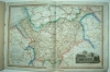
(Code No. 4166)WRIGHT, Thomas.The Royal Dictionary Cyclopaedia for universal reference. Biographical, Classical, Literary, Scientific, Geographical, and Technological.8 of 15 Volumes.London Printing & Publishing Co. ca1860. 4to, [7 1/2 x 10 ins.] Pp. 480 per volume (approx) + 33 Steel engraved portraits + 26 Steel engraved views + 18 Steel engraved folding world maps, drawn and engraved by J Rapkin. Showing Ireland Jamiaca, North Italy, South Africa, China, Africa, Australia, Asia, Asia Minor, British Isles, Russia in Europe, Scotland, Persia, Prussia, France, Germany and Greece, Original half morocco gilt over marbled boards, rubbing, splits to hinges and with slight loss. All edges gilt. All holding firm.
|
SOLD.
|
(Code No. 4152)Dugdale, Thomas.Curiosities of Great Britain England & Wales.11 Volumes.London. J, Tallis. ca1845. 8vo, [6 x 9 ins]. Pp 140 per volume, (approx) + 11 Steel engraved frontispieces, slight foxing + 11 Steel engraved title pages, slight foxing + 256 Steel engraved views, with tissue guards.+ 58 Double page engraved English & Welsh county maps by J Archer, 2 Northamptonshire maps, lacks Northumberland, (binding error), vg. Original cloth gilt, rubbing, splits with some loss. All holding firm.
|
SOLD.
|
(Code No. 4147)
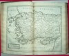
Gaultier, L'Abbé.
Petit Atlas de Géographie.
Paris. Jules Renouard Libraire, Rue de Tournon, 6. Ca1870. 4to [ 185 x 265 mm ]. Title-page, foxed + Adverts.+ 11 maps on 8 sheets, showing original hand coloured world maps, [as listed]. (Modern geography). Single sided. Twin world hemispheres, foxed, Europe, Europe central, France and Britain, Spain Portugal and Italy, Asia, Africa, America, Australia and Polynesia, slight foxing. Original boards with decorated paper title label, rubbed. £80.00
|
Click on picture above to view more images
How to order
|
(Code No. 4146)
DUSSIEUX, L.
Géographie Historique de la France ou Histoire de la Formation du Territoire Francais.
Paris, Didot. 1843. 8vo, 6 x 8 1/2 ins. Pp.191, (French text) + 33 Hand-coloured engraved (French territory, only) maps. Original quarter calf gilt. Hinges split with some surface loss. Still holding firm. £60.00
|
Click to view more images
How to order |
(Code No. 4133).
Williams, Lieut.-Col.
The Life and Times of the Late Duke of Wellington...
Volume 3, only.
London: John Tallis & Company. ca1850. 4to, [8 x 11 ins.] Pp 212 + Engraved title page + 5 Steel engraved plates + 3 hand coloured in outline John Tallis maps of France, Germany and Prussia, very good condition. Original cloth gilt, rubbed. £55.00
|
Click on picture above to view more images
How to order |
(Code No. 4131)A GAZETTEER OF THE WORLD. orDictionary of Geographical Knowledge, Compiled from the most recent authorities, and forming a Complete Body of Modern Geography....7 Volumes.Edinburgh. A. Fullarton. ca1860. 4to, [7 1/4 x 10 ins]. Pp approx 870 per volume + 45 Steel engraved hand coloured world maps + 57 Steel engraved world views. 9 plates missing, ( no plates cut out, publishing or binding error). Original half morocco gilt. Raised spine bands gilt, slight rubbing. All edges gilt. Fine set.
|
SOLD.
|
(Code No. 2408)Weekly Dispatch Atlas.London. Day & Son. ca1860. (Size 19 x 13.6 ins) 15 LOOSE FOLDING LITHOGRAPHIC MAPS AND TOWN PLANS, Engraved and drawn by Davies, Dower and Weller, with outline hand colour, some foxing, marks and a few splits to margins and folds. Maps shown - Cornwall, Leicestershire and Rutland, Derbyshire, Edinburgh, Somershire, Watering Places in Kent, Bedfordshire, Wiltshire, Herefordshire, Cambridgeshire, Devonshire Kent and Edinburghshire + Folding Town Plan of Liverpool drawn by Davies, (Size 19 x 27 ins) + "Naples Southern Portion and Sicily" with a panel inset map of Malta. This atlas was part of a very fine collection of maps which appeared originally in the Weekly Dispach newspaper from 1856 to 1862. They were then collected together and issued as the Dispach Atlas in 1863.
|
SOLD.
|
(Code No. 4116)
Brabner, J. H F.
The Comprehensive Gazetteer of England and Wales.
Volume 2 only.
London. W. Mackenzie. ca1890. 8vo, [7 1/2 x 10 1/2 ins.] Pp approx 350. 11 English & Welsh coloured county maps + 4 Topographical views, very good condition. .Cheshire, Cornwall, Cumberland, Denbigh & Flint, Derbyshire, Devonshire, Dorsetshire, Durham, Essex, Glamorgan, Gloucester. Original cloth gilt, chipping and marks. £55.00
|
Click on picture above to view more images
How to order |
(Code No. 4076)Bartholomew, John.The Royal Atlas of England and Wales reduced from the Ordnance Survey.London. G.Newnes. nd, ca1897. Folio, [ 10 x 14 1/2 ins ]. Pp xii, 72 (index,) including title page (as above) and Contents + 51 Double-page printed coloured maps + 27 Printed colour town plans on 19 sheets, some splits to centre folds, (no loss). Original decorated cloth gilt, slight chipping to bottom of spine.
|
SOLD
|
(Code No. 4055)Milner, Thomas Rev.The Gallery of Geography a Pictorial and Descriptive Tour of the World.London. W & R Chambers. 1864. 4to, [7 1/2 x 10 1/2 ins.] Pp xvi, 950 + 6 Full page steel engraved plates, including bird's eye views of New York, Mexico City and Sydney plus views of Naples, and Constantinople + 12 Double page printed colour world maps, engraved by J Bartholomew. Original half calf gilt, gilt, slight rubbing and marks.
|
SOLD.
|
(Code No. 4023)
Salmon. Thomas.
The Modern Universal Gazetteer: or, a General View of the Several Nations of the World.
Edinburgh. James Spotiswood. 1781.8vo, [4 1/2 x 7 1/2 ins]. Pp. Title + To the Public + Introduction + Text not paginated + List of Towns + A new Chronological Table + 6 Copper engraved folding World Maps by Thomas. Phinn :- World, (twin hemispheres), damaged. Europe, damaged. North America, split to folds. South America, split to folds. Africa. Asia, split to folds. Original full calf, poor. £130.00
|
Click on picture above to view more images
How to order
|
(Code No. 4000)Bryce, James and others.The International
Atlas and Geography: Modern, Historical, Classical and Physical.London.
Collins & Sons. No date, ca1870. Folio, [18.6 x 14.6 ins.] Pp 156,
38 index + 122 Printed colour engraved maps by J, Bartholomew and E, Weller.
Maps single sided, very good condition. Map list :- 60 Modern geography,
(19 America,) 16 Historical, 14 Classical, 8 Railway maps, 4 Astronomical
and 20 Physical geography. Original half morocco, marks and splits to hinges
with some loss.
|
SOLD
|
(Code No. 4006)The Harmsworth Atlas and Gazetteer. 500 Maps and Diagrams in Colour, with Commercial Statistics and Gazetteer Index of 105,000 Names.London. The Amalgamated Press. ca1906.Folio, [11 x 16 ins]. Pp. viii, 210, 32, (284 index, some browing to margins) + 210 Coloured double-page world maps,some with inset town plans, slight foxing. Original half morocco gilt. Raised spine bands with gilt-tooled panels. rubbed and marks.
|
SOLD
|
(Code No. 3984)(Welsh Encyclopaedia).2 of 10? Volumes.(
Atlas volumes).Denbigh.Thomas Gee Press. 1861 & 1879. 8vo, [ 7 x 10
ins ]. 24 Double and single page folding coloured World maps by Thomas
Gee, slight off setting, (rubs out easily). Original blind stamped decorated covers. Raised spine bands gilt with blind stamped decorated panels, slight rubbing. World maps with Welsh titles are uncommon.
|
SOLD
|
(Code No. 3983)Gazetteer. 500 Maps and Diagrams in Colour, with Commercial Statistics and Gazetteer Index of 105,000 Names.London. The Amalgamated Press. ca1906. Folio, [11 x 16 ins]. Pp. viii, 210, 32, (284 index) + 210 Coloured full and double-page world maps, one railway maps with splits to folds (no loss). Original half morocco gilt. Raised spine bands with gilt-tooled panels.
|
SOLD
|
(Code No. 3933)GREENWOOD, C & J.(7 Antique Maps)Maps of the Counties of Nottingham, Hertford, Lincoln, Worcester, Huntingdon, Westmoreland and Warwick.London, Greenwood & Co. 13 Regents Street Pall Mall.1830-34. Image size, 28½ x 23 ins, (approx) 7 Original beautiful hand coloured engraved maps, all with vignettes, water staining, nicks to margins. Sold with all faults.
|
SOLD.
|
(Code No. 3917)Churchill, Awnsham & John.A Collection of Voyages and Travels.Volume 6 only.London. A, Churchill for John Walthoe. 1732. Folio, [14 x 9 1/2 ins.] Pp. 1 -736, title page damaged + [20] Index, one page damaged + 4 Copper engraved world maps, two of China , North West passage and Harbour of Praya, ( the capital of Cape Verde ) + Text illustrations throughout. Voyages:- Description of the Kingdom of Tonqueen (North Vietnam, at the head of the Gulf of Tonkin) by S. Barron, Travels in Europe by J.G. Careri, A voyage to Virginia by Col. Norwood, Journal of his voyage from England to Cape Mounferadoe, (Africa) and forward to Barbados, Voyage into the North West Passage by J. Gatonese, "Three years Sufferings of R. Everard upon the coast of Madagascar", Description of the Mosqueto Kingdom in America, Two foreign sects in East Indies; Banians & Parsees by H. Lord, Wonder preservation of the Ship Terra Nova, Account of the King of Mocha, Isle of Bombay, Journal through Germany.., etc by P. Skippon. Lacks front cover.
|
SOLD
|
(Code No. 3901)Johnston, W. and A. K.Student's British Encyclopaedia Atlas.(Atlas volume only)London.Caxton Publishing Company. ca1880. 4to, [10 x 7 1/2 ins]. Title (as above) + Map List + 36 Double page coloured world maps (33) & Town Plans (3 Liverpool & Birkenhead, Manchester & London), some foxing. Original cloth gilt, slight marks.
|
SOLD.
|
(Code No. 3895)London. W. Mackenzie. ca1890. 8vo, [7 1/2 x 10 1/2 ins.] Pp approx 350 per volume + 14 Coloured town plans + 54 English & Welsh coloured county maps + 23 Topographical views, very good condition. Original cloth gilt, chipping and marks.
|
SOLD |
(Code No. 3882)SMITH, Montague.Concise Railway Rate of the Collieries and Shipping Rates on the English & Welsh Railways arranged for the Coal and Iron Trades.London. George Allan. 1913, 6th edn. Demy Folio, [11 x 15 ins]. Half Title + Title (as above) + Collieries + pp. 6-11 Index to Collieries + pp. 12-69 Collieries, (Names, Situation, Railways, Rates, Minerals & Seams worked) + pp. 302- 342 L. B. & S.C. Railway (Coal Rates from the Company's Waterside Wharves) + pp. 343 Blast Furnaces + pp. 376-407 British Ports, Harbours, Railways, Rivers, Canals, etc, with maps in the text + 30 Folding double and single page Maps of British Town plans, Harbours, Docks, Railway yards, etc, very good condition. Original half morocco, hinges split, still holding. No other reference to this work found.
|
SOLD |
(Code No. 3881)
Dugdale.Thomas & Cole and Roper.
Curiosities in Great Britain. ENGLAND and WALES.
4 Volumes of 6.
London. Tallis & Co. Circa 1830. 8vo [6 x 8.6ins]. Pp 324,164,304, 484 + 41 of 58 ENGLISH AND WELSH FOLDING COUNTY MAPS, engraved by J.ROPER drawn by G.COLE, (vols 4 & 6 missing) + 98 Steel engraved view plates. Original cloth gilt, rubbed.
Cole and Roper published "The British Atlas" with 58 English and Welsh county maps + 21 town plans in 1808-10. Dugdale used in his earlier editions of his Curiosities in Great Britain the Cole and Roper county maps minus the town plans, erasing all references to the map's origin. In his many later editions he used the J. Archer maps that are far more common and less attractive. £200.00 |
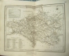
Click on picture above to view more images
How to order |
(Code No. 3839)London. George Philip & Son. 1888. 8vo, [5 x 7 1/4 ins]. Advert + Title (as above) + Contents + Coloured Irish county double page maps + pp. 41 Index. Original gilt stamped cloth, slight rubbing.
|
SOLD
|
(Code No. 3830)Walker. J and C. & J. Wyld.3 Antique County Maps of Oxfordshire, Buckinghamshire and Berkshire.London. Longman, Reese and Co. 12mo,[3 1/2 x 5 ins]. 1835-6. Map image sizes 13 x 15 3/4 ins. Page map sizes 13 1/2 x 16 1/2 ins. Pp (2) . Original linen backed sectional (15), folding steel engraved hand coloured County maps, very good condition. Original cloth with printed title on front covers.
|
SOLD.
|
(Code
No. 3824)Fisher's County Atlas.Part15,SOMERSETSHIRE & ESSEX.London. Fisher, Son, & Co. Sept
1st 1844. Folio [12 1/2 x 15 ins]. Original decorated soft cover
title, slight marks + Original steel engraved hand coloured Somersetshire
map, slight marks + Original steel engraved hand colouredEssex map, slight marks, with a separate index accompanying
each map + pp. (1) Publisher's advert.
|
SOLD
|
(Code
No. 3822)THE TIMES ATLAS.Containing 117 double and full-page colour printed maps,
Comprising 173 maps and an Alphabetical Index to 130,000 Names.London. The Office of the Times. 1897.
Folio, [11.6 x 16.6 ins]. Pp 118, vg. 117 double and full-page
colour printed maps, (as Listed), some maps with slight
foxing. Gilt decorated half morocco, rubbed & lower front hinge
split (2 ins). Gilt edges. Marbled end papers.
|
SOLD
|
(Code
No. 3821)London. George Philip & Son. 1888. Large 4to, [11 x 13 1/2 ins].
Title (as above), damaged ( surface loss ) + Engraved frontis Comparative
heights of Mountains map, (v blank), damaged + Contents (v
blank) + pp. xxvii (text) Physical Geography + 8 Coloured
maps on Mercator's Projection, very good condition + 48
Coloured World maps + map 29 in 2 parts, (as listed), England & Wales, slight damage, other maps, very good condition + pp.
(36) Index + pp. (7) Index, part 2. Original cloth gilt, covers
detached, lacks spine cloth. The more rare of the George Philips'
Atlases. |
SOLD |
(Code
No. 3813)Milner,Thomas Rev.The Gallery of Geography a Pictorial and Descriptive Tour
of the World.2 Volumes. Glasgow. W. R. M'Phun &
Son. ca1875. 4to, [7 1/2 x 10 ins]. Pp xvi, 1144 + 8 Full page steel
engraved plates, including bird's eye views of New York,
Mexico City and Sydney plus views of Venice, Naples, London,
Edinburgh and Constantinople + 12 Double page world maps + 16
Beautiful printed colour peasant costume plates, (Chromolithographs).
Original full morocco gilt. Raised spine bands with gilt - tooled
panels, slight rubbing and marks. All edges gilt.
|
SOLD
|
(Code
No. 3786)London. Fullarton. 8vo, [ 6 x 9 1/4 ins].
1838-46. Pp approx 300 per volume + Steel engraved views + World Maps with vignettes + World maps without
vignettes. Duplicate maps with vignettes, Denmark, South
Germany, Africa, Sweden. Duplicate maps without vignettes North
Germany , Egypt and South Africa. Five maps with damage, (no loss).
Original cloth gilt, Fading, and some damage to a few volumes.
|
SOLD
|
(Code
No. 3785)Paterson's Roads.Direct and Principal Cross Roads in England and Wales
with Part of the Roads of Scotland.London. Longman, Orme Brown and others.
1829, 18th edn. 8vo, [6 x 8 1/2 ins]. Pp 715 + 44 (Appendix, Across
the River Severn, Chepstow Steam Ferry and An arranged Tour through
Wales) + 9 Folding maps by Edward Mogg, (as listed),
general map (loose),split with slight loss to margin. Original half
calf, spine missing and front board detached.
|
SOLD.
|
(Code
No. 3783)
TYRRELL, Henry.
The History of the War with Russia: Giving Full Details
of the Operations of the Allied Armies.
Divisions 3, 4 & 5.
London Printing Co. ca1860. 4to [290
x 200 mm.] Pp 189 to 379, 1-192, 1-188. 24 Steel engraved portraits
and views including two views of Malta, Gibraltar
+ Florance Nightingale, water staining + 4 maps by John
Tallis with vignettes and out line hand colouring, very
good. Original cloth gilt. slight rubbing and fading. £60.00
|
Click on picture above to view more images
How
to order |
(Code No. 3680)London. Mackenzie. Ca1870. Large 8vo. Size 260 x 190mm or 10 1/2
X 7 1/2 Ins. Pp 1198 + Engraved title vignette + 24 Steel
engraved plates, that includes, views of New York, Sydney,
Liverpool, River Trent, Richmond, Cabul, Calcutta, Sydney, Mexico
City, New York, St Petersburg, Mexico, Stratford Upon Avon, Stirling,
etc + 36 Coloured double page world maps. Original
gilt-decorated cloth, some minor chipping and rubbing. |
SOLD |
(Code No. 3710).
D'Anville, Jean Baptiste Bourguignon, [1697-1782].
(Antique Map of Eastern Hemisphere).
Orbis Veteribus Notus Auspiciis Serenissimi Principis
Ludovici Philippi Aurelianorum Ducis Publici Juris Factus.
Paris: J.B.B. D'Anville. 1763 . Size,
55 x 76cm or 30 x 21 1/2 ins. Original copper engraved hand coloured
map of the Eastern Hemisphere. £130.00
|
Click on picture above to view more images
How to order
|
(Code No. 3707.)
BLACKIE, W.G.
(12 Antique World Maps.)
Cape of Good Hope, Africa, The British Isles, The World,
Central Europe, Australia & New Zealand, South America, Asia,
British North America, Europe, North America.
London. Blackie & Son. ca1870. Page
size (approx) 15 1/2 x 21 1/2 ins. Image size (approx) 19 1/2 x
13 ins. 12 Folding steel engraved world maps with
outline hand colour, engraved and drawn by Edward Weller & J.W.
Lowry. Most maps have split to fold and are strengthened on back.
Cape of Good Hope, Africa, The British Isles, split into engraved
area (2 1/2 ins), The World, split into engraved area (2 1/2 ins),
Central Europe, split into engraved area (1ins), Australia &
New Zealand, split into engraved area (1 1/2 ins), South America,
split into engraved area (1 ins), Asia, split into engraved area
(2 ins), British North America, split into engraved area (3 ins),
Europe, split into engraved area (2 1/2 ins), North America. West
India Islands & Central America, split into engraved area (3
ins). £110.00
|
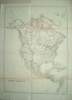
Click on picture above to view more images
How to order
|
(Code No. 3706)
Rapkin. J.
(18 Antique Maps.)
2 x The British Isles, Scotland, 2 x Southern Italy, The
World, Europe, England & Wales, 2 x Northern Italy, France,
West India Islands, Asia Minor, Switzerland, British India, Russia
in Europe, Turkey in Europe, Spain & Portugal.
London. London Printing and Publishing
Company. 1860. Page size, (approx) 15 1/4 x 11 1/4 ins. Image size,
(approx) 12 x 9 1/4 ins. 18 Folding steel engraved world
maps, engraved and drawn by J. Rapkin. 2 x Southern Italy,
2 x The British Isles, foxing to folds of one map. Scotland, split
just affecting decorated border. The World, slight splits to folds.
Europe, England & Wales, 2 x Northern Italy, foxing to top fold
of one map. France, West India Islands, foxing to top fold. Asia
Minor, slight water staining. Switzerland, British India, Russia
in Europe, slight foxing. Turkey in Europe, crease to top right
corner. Spain & Portugal, slight foxing & split to fold
just affecting decorated border. £150.00 |
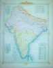
Click on picture above to view more images
How to order |
(Code
No. 3670).Edinburgh. William, Blackwood & Sons.1869.
Royal Folio, [20 x 13 1/2 ins.] pp. (4) Index Geographicus, often
missing, slight foxing + Half title (v. blank) + Title page (v.
blank) + Dedication (v. blank) + pp. vii-viii Preface, slight foxing
+ Contents (v. blank), slight tear to blank margin + 48
Double page World maps with outline colour, very good,
a separate index accompanying each map, a few maps with slight foxing,
France, split to centre fold. Original half morocco gilt. Raised
spine bands with gilt-tooled panels, slight rubbing & marks.
All edges gilt. Five years of preparation was devoted to the publication
of this atlas. Please email for postal rates.
|
SOLD |
(Code
No. 3669).London. Printing & Publishing. ca1850. 4to,
[11 x 8 ins]. Pp 392, 319, 432 iv, 338, 384 and 378 xxix + Title
pages +2 Additional steel engraved vignette titles + 49 Portraits
+74 Steel engraved plates + 2 Plans + 7 Maps with outline
hand colour. Original half calf, slight chipping to top
of spine and slight rubbing. |
SOLD |
(Code No. 3602)London. Printed by the Author at his
House in White-Fryers. Folio, [11 x 17 ins]. 1675. Frontis ( v.
blank ), wormhole to left side + Title as above ( v. blank ) + Dedication
pp. (3) ( v. blank ) + Preface pp. (5) ( v. blank ) + Post Roads & Advertisement pp. (3) + City of London pp. (8) + Catalogue
of Roads & Accidents pp. (4) + Text pp. 1 to 200. LACKING
ALL STRIP ROAD MAPS. Original full calf. Raised spine bands
with gilt-tooled panels, poor. The Frontispiece gives a lively and
accurate picture of map-making in the 17th century. Road surveyors
on horseback and on foot, bridges, windmill and gibbet, of special
note a distance measuring way wiser or perambulator being guided
by two men. The text is intended to lists extra topographical details
etc, to each of the Ogilby strip road maps.
|
SOLD |
(Code No. 3615)Johnston. Keith.The
Royal Atlas of Modern Geography.Edinburgh. W & A.K.
Johnston. Royal Folio, [20 x 13 1/2 ins.] 1913. Half title
(v. blank) + Frontis, 2 Polar Charts + Title page
(v. blank) + Dedication (v. blank) + Preface
(v. blank) + Contents pp. (2) (v. blank) + 58 Double page
world maps with outline colour and a separate index accompanying
each map. (as listed), a few maps loose , Hemisphere map, split
just affecting image area. Oceania map taken from one of Johnston's
earlier editions. All other maps very good. Original half morocco
gilt, split to front hinge. Binding still holding. All edges gilt.
Email for postal rates.
|
SOLD.
|
(Code No. 3603) Edinburgh. William, Blackwood & Sons. 4to, [10 1/2 x 15 ins]. 1874, 2nd edn. Title page (v. blank)
+ Dedication (v. blank) + Preface pp. (2) + Contents (v. blank)
+ Double page world maps with outline hand colour, engraved & printed by W & A. K Johnston, (as listed), very
good condition + Index pp.1 to 100 + Johnston's advert for the large
folio atlas "The Royal Atlas of Modern Geography." Original
binding, poor. All edges gilt. This Handy Royal Atlas is a slightly
reduced version in size of the Johnston's "The Royal Atlas
of Modern Geography" 1861.
|
SOLD
|
(Code No.3583)
Letts.
Popular County Atlas. ENGLAND & WALES.
London. Letts. Son & Co Limited.
1884. Folio, [9 1/2 x 14 ins]. Title + Contents, (maps in alphabetical
order), nicks to edges, (no loss) + 34 of 47 Printed &
outline hand coloured double page England & Wales County maps,
(Loose), a few splits into engraved fold areas, (no loss)
+ pp.34, (index, poor condition.) Missing Maps: - Derbyshire, Durham,
Gloucestershire, Herefordshire, Lincolnshire, Northumberland, Warwickshire
+ the 3 Yorkshire and 3 of the 4 Welsh Maps. Original cloth gilt,
slight splits to front hinge & rubbing wear. Holding firm.......
£180.00 |
Click on picture above to view more images
How to order
|
(Code No. 3582)Letts.Popular Atlas.London. Letts. Son & Co Limited. 1881. Folio, [9 1/2 x 14
ins]. Title + Preface + Contents, (maps in alphabetical order) + 61 Printed & outline hand coloured double page world maps, (as
listed ) + pp.71, (index), a few splits into engraved areas,
(no loss), Included 11 maps of America, Original cloth gilt, splits
to front hinge & rubbing wear. Holding firm.
|
SOLD.
|
(Code No. 3568)
Dalton. William, Hugh, pseud. [i.e. Alexander Hogg.]
The New and Complete ENGLISH TRAVELLER: or, a New Historical
Survey and Modern Description of England and Wales.
London. Alexander Hogg. nd, ca1790.
Folio {15 x 10 ins]. Engraved Frontis + Title Page + pp.2 Preface
+ pp.2 Introduction + pp. 7-520 + pp. 4 Index + pp.4 Subscribers.
Including 37 MAPS on 16 PAGES by T. Conder and others, (as
listed). 72 engraved views on 45 Full pages, (
52 full page views listed in "Plate List" ), 3 plates
slightly cropped. Original tree calf, hinges split, Attractive town
views plus many village views especially of the London and south
east of England. The maps show compass points, Coat of arms and
decorative title panels, in a rural setting. This work is one of
the more rare of the late 18th century UK travel books.
£1,200.00
|
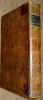
Click on picture above to view more images
How to order
|
(Code No. 2132)
TOMLINS. F.G.
A Complete System of Geography, Ancient & Modern;
Comprising A Full Description of the World.
London. Joseph Smith. 1841. 8vo [ 170
x240 mm ]. Pp xi 1067 + 15 FULL PAGE COPPER ENGRAVED WORLD
MAPS, that includes 2 Twin hemisphere maps, ( The World
on a Spheric Projection and World from the Pole to the Tropics )
plus The World on Mercator's Projection and 4 American maps. Original
reverse calf gilt, slight wear. £175.00
|
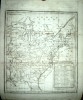
Click on picture above to view more images
How
to order |
(Code No 3224)Grose, Francis:The Antiquities of England and Wales. 6 Volumes. LARGE PAPER COPY.London. S, Hooper. Ca1780. Folio, [10 x 13 ins.] Pp 83 + 6
Engraved frontis + 6 vignettes titles pages + Approx 633 COPPER
ENGRAVED VIEWS and PLANS, [ Town views, castles, priories,
churches, bridges etc ], some folding. + Large original hand coloured
folding map + 55 HALF-PAGE ORIGINAL OUTLINE HAND COLOURED
COPPER ENGRAVED ENGLISH and WELSH COUNTY MAPS + extra map (not
listed) Radnorshire map and plates, missing, (Publishing error),
each plate with descriptive text . [ Francis Grose used John Seller's
maps of 1701 with slight alterations for this work.] Original full
tree polished calf with decorative gilt borders. Raised spine bands
gilt with gilt-tooled panels, with some loss. Splits to hinges,
still firm. Marbled end papers. Francis Grose appears to vary the
number of plates for each edition. Large paper copies with
original outline hand coloured maps also with the text and plates
free from foxing etc, are very rare.
|
SOLD.
|
(Code No.3504)
Halma Franciscus & Bos, Lambertus.
Vetus Testamentum Ex Versione Septuaginta Interpretum.
Netherlands. Franeker.Halma. 4to [8
x 10 1/2 ins or 267 x 210mm. ]. 2 Volumes. 1709. Engraved Frontis
+ Title vignette + pp. (38) Prolegomena, Latin text + pp.1- 1326
Greek text + 4 Maps that includes the World map on Mercator's
Projection showing California as an Island + folding plate.
Contemporary full calf, gilt. Title labels missing, hinges split.
From the Toft Hall Library, Cheshire with Sir Peter Leycester's
book plate. £600.00
|
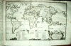
Click on picture above to view more images
How to order |
(Code
no. 3519)London, Hodder and Stoughton. 4to, [9 x 11 ins].
[1869]. Half title + Title + pp. (2) introduction + pp. (1) contents
+ pp. (4) adverts + 8 of 12 Vivid chromolithographic maps, loose, (perished gutta-percha), depicting in human form
various peculiar distortions of the political geography of mid-nineteenth
century Europe, slight foxing. Original gilt-decorated cloth, damaged.
The maps and rhymes were designed to amuse children and help them
memorise the outline of European countries.
|
SOLD |
(Code No. 3535).The Encyclopeadia Britannica. Volume 34 only. (Map volume).Edinburgh, London. Adam and Charles Black.
1903 10th edn. Medium 4to [9 x 12ins]. Pp 428 ,vg. 124 Double page
coloured world maps, including 66 double page coloured maps
of separate American States, decorated with piano key borders,
most U.S.A. State maps with inset town plans, vg. Single sided.
Half morocco gilt. Raised spine bands with gilt decorated panel,
slightly rubbed and marks.
|
SOLD
|
(Code No. 3534.)The Harmsworth Atlas and Gazetteer. 500 Maps and Diagrams
in Colour, with Commercial Statistics and Gazetteer Index of 105,000
Names.London. The Amalgamated Press. Folio
[11 x 16 ins]. ca1906. Pp. viii, 210, 32, (284 index) +
210 Coloured double-page world maps, slight foxing & a few nicks to blank margins, two railway maps with splits to folds
(no loss). Original half morocco gilt. Raised spine bands with gilt-tooled
panels, slight split to top of spine. Still firm.
|
SOLD
|
(Code No. 3537.)D'Anville. M.Géographie Ancienne, Abrégée.Paris.
Théophile Barrois. 8vo,
[4 1/2 X 7 Ins]. 1782. 1 Volume of 3. Pp xxiv 341 (1) errata + 6
Folding European maps, slight nick to folds, very good.
Original full calf, lacks spine.
|
SOLD
|
(Code
No. 3516)Camden. William.Camden's
Britannia Abridg'd with Improvements, and Continuations, to the
present Time. 2 Volumes.London.
Printed by J.B. for Joseph Wild. 1701. Crown 8vo [7.5 x 5 ins].
Engraved frontis portrait of William Camden + 2 Title-Pages (v.
blank) + pp. (3) Dedication. (v blank) + pp. (6) The Preface
+ pp (14) The Life of Mr Camden + pp. (8) List of Nobility +
pp.1-822 Text + pp.1-103 Text (v. blank) + pp. (4) Index, water
stained to some corners of text pages, not affecting maps, + 64
COPPER ENGRAVED COUNTY MAPS by JOHN SELLER, vg. 60 maps
called for in "Map List", duplicates. Original polished
full calf, ruled blind stamped. Raised spine bands with gilt-tooled
panel, rubbed with slight loss.
|
SOLD.
|
(Code
No.3429)London. Sudbury and Humble. 1611. Page size 91/2
x 14 ins. Original copper engraved title page to "The
Theatre of the Empire of Great Britaine" nicks to
edges and cropping to right side with some loss. Guaranteed to be
over 300 years old.
|
SOLD |
(Code No. 3470)
Speed. John.
( Title page + Frontispiece + Irish map list )
The Fourth Booke: Containing, The Kingdome of Ireland.
London. Imprinted by John Dawson, for
George Humble. 1627. Page size 17 1/2 x 11 ins. Image size 9 1/2
x 14 3/4 ins. Pp (3) Original copper engraved title page, frontispiece
and Irish map list to "The Theatre of the Empire of Great Britaine".
Guaranteed to be over 300 years old. £130.00 |
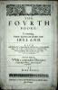
Click on picture above to view more images
How to order .
|
(Code No.3428)
Speed. John.
( Title page + Frontispiece + Irish map list )
"The Fourth Booke: Containing,
The Kingdome of Ireland"
London. Imprinted by William Hall. 1611.
Page size 17 1/2 x 11 ins. Image size 9 1/2 x 14 3/4 ins. Pp (3)
Original copper engraved title page, frontispiece and map
list for the "The Theatre of the Empire of Great Britaine".
Guaranteed to be over 300 years old. £130.00
|
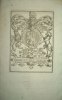
Click on picture above to view more images
How to order
|
(Code No. 3427)Speed. JohnFrontispiece to the Theatrum.London. Bassett and Chiswell.
1676. Page size 17 1/2 x 11 ins. Image size 9 1/2 x 14 3/4 ins.
Original copper engraved frontispiece to "The Theatre
of the Empire of Great Britaine" by Jodocus Hondius,
nicks to edges with some loss, mostly to blank margins. Showing
the Arms of the Kings of Great Britain with the Royal coat arms
in the centre. Guaranteed to be over 300 years old
|
SOLD
|
(Code No. 3426)Speed. JohnTitle Page.London. Bassett and Chiswell. 1676.
Page size 17 1/2 x 11 ins. Image size 9 1/2 x 14 3/4 ins. Original
copper engraved title page for the "The Theatre of
the Empire of Great Britaine" by R. White, nicks to
edges with slight loss. Guaranteed to be over 300 years old.
|
SOLD
|
| Code No.3357. Edinburgh. William, Blackwood & Sons. Royal Folio, [20
x 13 1/2 ins.] 1861. Pp. Half title (v. blank) + Title page (v. blank)
+ Dedication (v. blank) + vii-viii Preface, slight mark to outer edges
of blank margin + Contents (v. blank) + 48 Double page World
maps with outline colour and a separate index accompanying
each map, very good. Original half morocco gilt. Raised spine bands
with gilt-tooled panels, slight rubbing & marks. All edges gilt.
Five years of preparation was devoted to the publication of this atlas.
Please email for postal rates. |
SOLD |
(Code
No. 3388)Edinburgh. Royal
Folio, [20 x 13 1/2 ins.] 1880. Pp. Half title (v. blank)
+ Frontis, Polar Chart + Title page (v. blank) + Dedication
(v. blank) + vii-viii Preface + Contents (v. blank) + 50
Double page world maps, (as listed) a few maps loose with
slight nicks to outer edge of blank margins, all other maps very
good + 2 Duplicate maps (Southern England & Africa), all maps
with outline colour and a separate index accompanying each map.
Original half morocco gilt, poor. Binding still holding. All
edges gilt. Apart from the extra maps in this edition the
maps only vary slightly from the 1861,1st edition . Please
email for postal rates. |
SOLD |
(Code No. 3291)
Star Charts, (7 Antique Star Charts.)
London. No Dates, approx 1870-90, 7 Coloured and black and
white engraved Star Charts. Sizes approx 9 1/2 x 13 1/2
ins to 25 1/2 x 20 ins. £70.00
|

Click on picture above to view more images
How to order |
| (Code no. 3493)London.
Alex Hogg and others. nd. ca1795. Folio, [10 1/2 x 16 1/2 ins].
Pp. iv, Engraved frontis + Title page + preface + text pp.1 to 538
+ pp. (6) contents + pp. (3) addenda & plate list, (48 + engraved
frontis, listed) + pp. (4) subscribers' names + (33) VIEWS
+ (4) TOWN PLANS of LONDON, 2 folding, slight corner water
staining + (7) PLANS of WARDS + (5) Misc.
Plate No. 39, (The Jewish manner of holding up the law
at Duke's Place) has been replaced with another plate, (publishing
error) Original full calf, rubbed. Raised spined bands gilt, rubbed.
Covers detached. Rare Copy. |
SOLD
|
(Code No. 3289)
Philip, George & Son.
(14 Antique Maps)
New General Atlas.
Liverpool. George Philip. 1851. Page size approx 54 x 67 cm. 14
Hand - coloured double-page world maps by J.Gellatly, slight
foxing and a few edge nicks throughout. Maps shown, "Russian
Empire", "Hindostan" (Northern part also with inset
maps of Nepal and Afghanistan), "Hindostan" (Southern
Part), "Asia", "Venetian States", "Principal
Rivers", (damaged), "Denmark", (with inset maps of
Iceland and Faeroe Islands): "Chart of the North & Baltic
Seas etc", (Inset maps of the Harbours of St Petersburg, Revel
and Heligoland taken from another edition? folded with splits to
folds), "Europe", "Palestine", "Sweden
and Norway", "The World on Mercators Projection",
"Philips Map of the Seat of War" Crimea War, from another
edition?, folded, dated 1854) "Chinese Tartary, Hindostan,
China etc". £250.00 |

Click on picture above to view more images
How
to order |
(Code
No. 3286)Collins & Sons. London. nd, ca1870. Folio, Size 18.6
x 14.6 ins. Pp 156 + 38 index, some slight marks mostly in blank
margins + 130 Printed coloured engraved maps, by
J, Bartholomew and E, Weller. Maps single sided. Original cloth
boards, canvas spine, poor. Contents, 60 Modern geography, (19 America,)
16 Historical, 14 Classical, 8 Railway maps, 4 Astronomical and
20 Physical geography. |
SOLD |
(Code No. 3296)Weekly Dispatch Atlas.THE WORLD on MERCATOR'S PROJECTION. (Large-Scale Antique Map).Date. ca1860.London. Day & Son. Page size, (approx), 24 x 18 ins. LARGE FOLDING HAND COLOURED LITHOGRAPHIC PRINTED MAP Engraved by E. Weller, 2 marginal nicks just affecting engraving.......
|
SOLD.
|
(Code No. 3292)
North and South Polar Regions.
(13 Antique Polar Maps.)
London. No Dates, ca1900 -13. Coloured maps by A. Gross,
Bartholomew, Bacon, W & A. K Johnston and E. Stanford
etc, some marginal creases and edge nicks, Map sizes 26 x 22 ins
to 20 x 14 ins. 4 duplicates of the South Pole by J. Bartholomew, £70.00 |
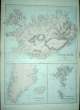
Click on picture above to view more images
How to order |
(Code no. 3287)Letts.(57 Antique Maps.)Popular Atlas.
London. Letts. Son & Co. ca1880. Folio, (430 x 370mm) or approx
17 x 14 ins. 57 Hand - coloured in outline full page world
maps, (all loose, no text or covers) Included 21 Europe,
14 Russia, (complete), 17 Asia, China, Asiatic Archipelago, Japan
and 13 of India (complete) and 5 Middle East including 1 map of
the Arabian peninsular, vg.
|
SOLD
|
|
(Code
No: 2024)Paris.
N. Pepingue. 1670. 12mo [155 x 95 mm.] 2nd part EUROPE.Pp 337 -
650. Engraved coloured title. Double page coloured table, vg. 31
DOUBLE PAGE COMTEMPORARY OUTLINE HAND COLOURED MAPS,vg. 25 Full-page contemporary hand coloured coats of arms, vg.
The maps decorated with title cartouche some have distance scale
plus gradations of longitude and latitude in inner border. Original
polished full calf gilt. Raised spine bands with elaborate gilt-tooled
panels, slight damage to top and bottom of spine. Marbled end papers.
|
SOLD |
(Code No. 3342)Mavor, William.6 Volumes
of 25 volumes.
UNIVERSAL HISTORY, ANCIENT AND MODERN FROM THE EARLIEST RECORDS
OF TIME TO THE GENERAL PEACE OF 1802.London. Richard Phillips. 12mo [ 4 x 6 ins ]. 1803. Pp. Approx 370
per volume. Engraved frontispieces + Title pages + Additional Title
pages + 2 Folding engraved maps (Africa & Europe, very
good) engraved by Smith & Jones taken from surveys
by Rendell and others. Titles:- "India & China", "England",
"India, Korea and Japan", "Italy and Venice",
"Hungary, Holland and Switzerland.", "Modern Egypt
and African Nations". Numbers - 11, 12, 13, 16, 18, 20. Original
full tree calf gilt, slight scuffing and rubbing. Still firm.
|
SOLD.
|
(Code No. 2091)
BLAIR. D.
The General School Atlas of Modern Geography.
London. Allman. 1853. 4to [ 9 x 11 ins]. Engraved title. List of
plates. 22 ENGRAVED WORLD MAPS with original out
line hand colouring. 3 maps with writing on the back of maps not
affecting map image, vg. Original half calf gilt with gilt- decorated
cloth covers, marks and part of spine missing. End papers (publisher's
book advert listings) marked. Tight copy. £220.00 |
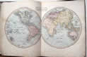
Click on picture above to view more images
How to order
|
| (Code
No: 2242) London.
C. Hitch etc. 5th Edition. 1761. Size 173 x 108mm. Title page +
Preface vi + pp.Text 271 + (23) index + 41 MAPS ON 34 PAGES
by J.Cowley, Approx map sizes 230 x 127mm to 70 x 65mm.
Full modern calf. 5 Maps of America, (California shown as
an island) 7 Maps of Africa. 8 Maps of Asia. All maps have
wide blank margins, No map images cropped. |
SOLD |
| (Code
No. 2052)
Anon.
International
Atlas. The United States. The World. Indexed. Containing separate
Maps of each State of the United States.
Chicago.
Thompson & Thomas. 1903. Folio [12 x 15ins].Pp 258, some nicks
to edges, not affecting images. 55 Full-page & double
page coloured lithograph maps of separate American States &
29 full-page & double page coloured lithograph World maps.
5 Coloured full-page statistical diagrams. Maps on both sides of
page leaf. The state maps are in rich colours and most have statistical
details to sides of maps listing the counties, chief cities and
population numbers according to the 20th official census. Original
decorated cloth, rubbed and slight fading. £130.00.
|
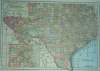
Click on picture above to view more images
How to order |
(Code
No.2979)
Migeon. J .
Géographie Universelle.
Paris: J. Migeon, ca1860, 1st Edition. Folio, (11
x 14 1/2 ins) Pp (83) Engraved title page. 39 Double page
steel engraved hand coloured modern world maps. (As listed),
Slight foxing throughout,vg. Including 26 maps with
steel engraved vignette views. Approx image size 15 x 11
ins. Original cloth, poor condition. Géographie Universelleis
is one of the last decorative atlases, most maps being adorned with
vignettes depicting the life and inhabitants of the region delineated.
£350.00
|
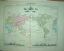
Click on picture above to view more images
How to order
|
(Code
no. 2983)
Thomson. John:
CHART OF THE WORLD.
"Hydrographical
Chart of the World on Wright or Mercator's Projection with Tracts
of the Last Circumnavigators"
Edinburgh. J.Thomson &
Co. Date 1814. Image size 45 x 50 cm. (17½ x 19½ in.)
Double page engraved World Map drawn and engraved for J.Thomson,
Engraved by R. Scott. with original outline hand colour,
some colours have faded, slight split to centre fold, vg. World
map on Mercator's Projection showing the routes of the late 18th
century explorers, Gores, Clerke, Perouse, Vancouver, James Cook
and others. £120.00 |
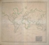
Click on picture above to view more images
How to order
|
(Code
No:
3043)Ca1850.
Size 14 1/2 x 9 1/2 ins. Original Hand Coloured Steel Engraved Twin
Hemisphere Map of the World by T. Gee, slight closed split to fold
and marks to blank margins. World maps with Welsh text are uncommon.
|
SOLD
|
(Code
No:
3272) Hughes. William. (Ed)PHILIPS’COMPREHENSIVE SCHOOL ATLAS OF ANCIENT and MODERN GEOGRAPHY.Philip & Son, Liverpool, 1867. 4to [190 x 280 mm.] Pp 46, index.
+ [(4) adverts]. Engraved frontis, [Principal rivers.] 40
Double page coloured world maps, Map 22 duplicated, replacing
map 32 ( publication error ) Single sided, including double page
folding twin hemisphere world map. Some light marking to blank margins.
Original cloth gilt, new spines. .
|
SOLD
|
(Code
No. 3184)
Mitchell. Augustus.
S.
Mitchell's Intermediate
or Secondary Geography, (Revised Edition) A System of Modern Geography,
Comprising a Description of the Present State of the World.
Philadelphia: H. Cowperthwait
& Company. 1858. 4to, [10 x 12 ins]. Pp 78, 6, some slight spotting.
41 HAND COLOURED ENGRAVED WORLD MAPS, some slight
spotting. Text woodcut engravings throughout. Original pictorial
boards, rubbed & spine, poor condition. £130.00 |

Click on picture above to view more images
How to order
|
| (Code No. 3251). BARCLAY. James, Rev.A Complete and Universal Dictionary of the English Language. Bungay. Brightly & Childs. 1823. 4to,[ 9 1/2 x 11
ins]. Pp xxiii, 728, Foxing and browning,(as usual). Engraved
frontis + Title page + 27 Copper engraved plates, foxing throughout,
(as usual). Showing, diving bell, Herschel's 40 foot telescope ballooning,mining and whaling etc. 21 ORIGINAL HAND COLOURED WORLD MAPS. Original full calf, very good condition. |
SOLD
|
(Code No. 3290)
Title Pages.
(15 Antique Atlas Title Pages)
London. Dates 1793 to 1857. Sizes 21 x 15 ins to 10 1/2 x 12 1/2
ins. 15 Steel and copper engraved title pages, edge nicks and foxing
throughout. Title pages shown, Wilkinson's Atlas Classica, 4to, ca1798. Laurie
and Whittle's Traveller's Companion, 4to,1806. A.K Johnston's National Atlas,
folio, 1857. 2 x Teesdale's New British Atlas, folio, 1833. Cassell's County
Atlas, 1860. Murray's An Atlas of the English Counties, folio, ca1830. J & C
Walker's The British Atlas, Folio, 1856. 3 x Smith's English Atlas, folio,
1804. Hobson's Fox-Hunting Atlas, 4to, ca1850. Cary's New English Atlas,
large folio,1809. Cary's New and Correct English Atlas, 4to, 1793. Ellis's
New and Correct Atlas of England and Wales, 4to, ca1819. £110.00. |

Click on picture above to view more images
How to order
|
(Code No. 3300)Johnston, Keith.5 Large-Scale Antique Maps.
The Physical Atlas of Natural Phenomena.Edinburgh & London. Blackwood & Son. 1856. Large Folio,
[24 x 22 ins]. 5 Hand-coloured part lithographic, steel
and colour printed maps by Berghaus and Kombst. Maps shown,
Important Plants, Ethnographic map of Europe, slight split to fold.
Mountain Chain of Europe and Asia, Humboldt's System of Isothermal
Lines over the globe, Current's of Air, (World)
|
SOLD. |
(Code
No.3181)London Printing Co. ca1860.
4to [290 x 200 mm.] Pp 384,380,338 + xxxix. 3 Title pages. 52 Steel
engraved portraits and views including two attractive views of Malta
and Gibraltar+3 engraved vignette title pages and 7 maps including
4 maps by John Tallis with vignettes and out line hand colouring,
[as listed] some foxing. Original half calf gilt. Raised spine bands
with decorated embossed panels, slight rubbing.
|
SOLD |
(Code
No. 3484)London. J. Walker and
others. 8vo, [6 x 8 1/2 ins]. 1805. Pp x, (6), 671 + 5 plates +
25 Folding world maps, one coloured, vg. Modern half morocco gilt.
|
SOLD |
(Code No. 3486)London. R. Francklin and others.
12mo, [ 4 x 6 1/2 ins.] 1757, 8th edn..Vol 4, only. Engraved frontis +
Title, v blank + Dedication + pp.1-356 text + pp. (12) index + 6 Celestial
diagrams + 3 of 4 Folding star charts + 10 Folding world maps + 7 Telescopes,
armillary, globes, planet motions and diagrams. Original full calf, poor.
|
SOLD |
| (Code No.3254) Johnston, Alex Keith: A School Atlas of General and Descriptive Geography. Exhibiting the Actual and Comparative Extent of all the Countries In the World, with their Present Political Divisions, Founded on the Most Recent Discoveries and Rectification London. Blackwood. 1873, new edition. 8vo, [7 1/2 x 11 1/2 ins]. Pp. 40 (6) adverts. 25 of 26 Printed colour engraved world maps, Map of Italy, missing, slight damage to 1st 3 maps. Quarter morocco, some loss. Cloth gilt, slight marks. |
SOLD |
(Code
No. 3443)London: R Baldwin, 8vo,
[5 1/2 x 8 1/2 ins] . Pp 606, (18) index, (2) plate list & advert
+ 32 Copper engraved plates (complete), that includes, 7
maps by T. Kitchin, very good + 10 portraits, one damaged
+ 11 town views, very good + Misc. Maps - Isle
of Man, Herefordshire, West Virginia U.S.A, Cardiganshire, Carmarthenshire,
Coromandel, Biddeford UK. Town Views - Portsmouth, Fort St George
Madras, Bridge at Hampton Court, Liverpool, Cape of Good Hope, Bombay,
Fort William Bengal, Batavia, Island of St Helena etc, Original
half calf, rubbed. Still holding firm.
|
SOLD |
A Guide to Antique Atlases:
Dated: 1577 - 1799 , 1800 - 1850
|
|
Return to top |
|